MyTopo
Paradise NW Kansas US Topo Map
Couldn't load pickup availability
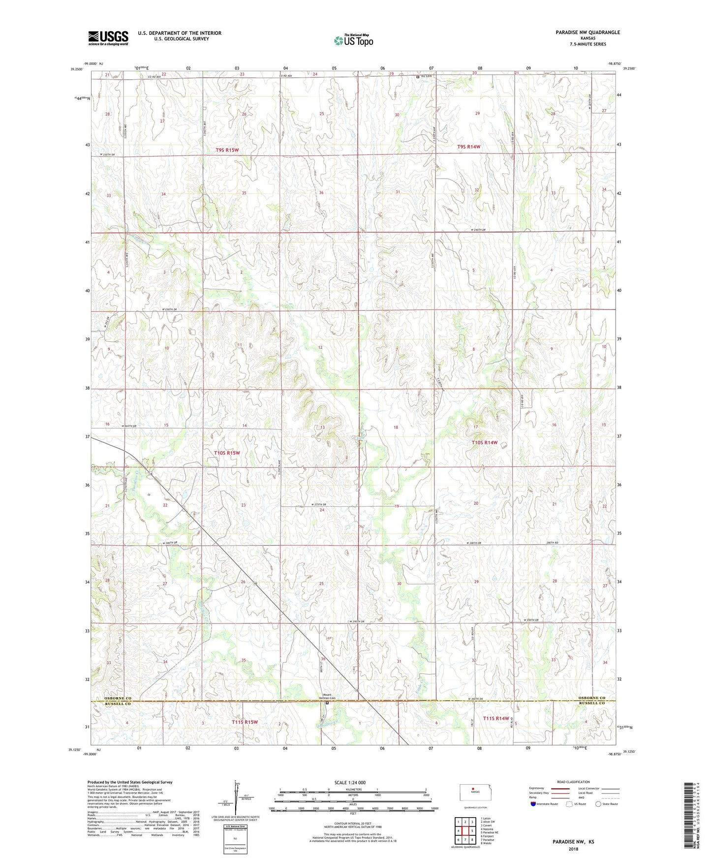
2022 topographic map quadrangle Paradise NW in the state of Kansas. Scale: 1:24000. Based on the newly updated USGS 7.5' US Topo map series, this map is in the following counties: Osborne, Russell. The map contains contour data, water features, and other items you are used to seeing on USGS maps, but also has updated roads and other features. This is the next generation of topographic maps. Printed on high-quality waterproof paper with UV fade-resistant inks.
Quads adjacent to this one:
West: Natoma
Northwest: Laton
North: Alton SW
Northeast: Covert
East: Paradise NE
Southeast: Waldo
South: Paradise
Southwest: Fairport
This map covers the same area as the classic USGS quad with code o39098b8.
Contains the following named places: IXL Cemetery, Mount Herman Cemetery, Township of Liberty, Township of Natoma