MyTopo
Paradise Kansas US Topo Map
Couldn't load pickup availability
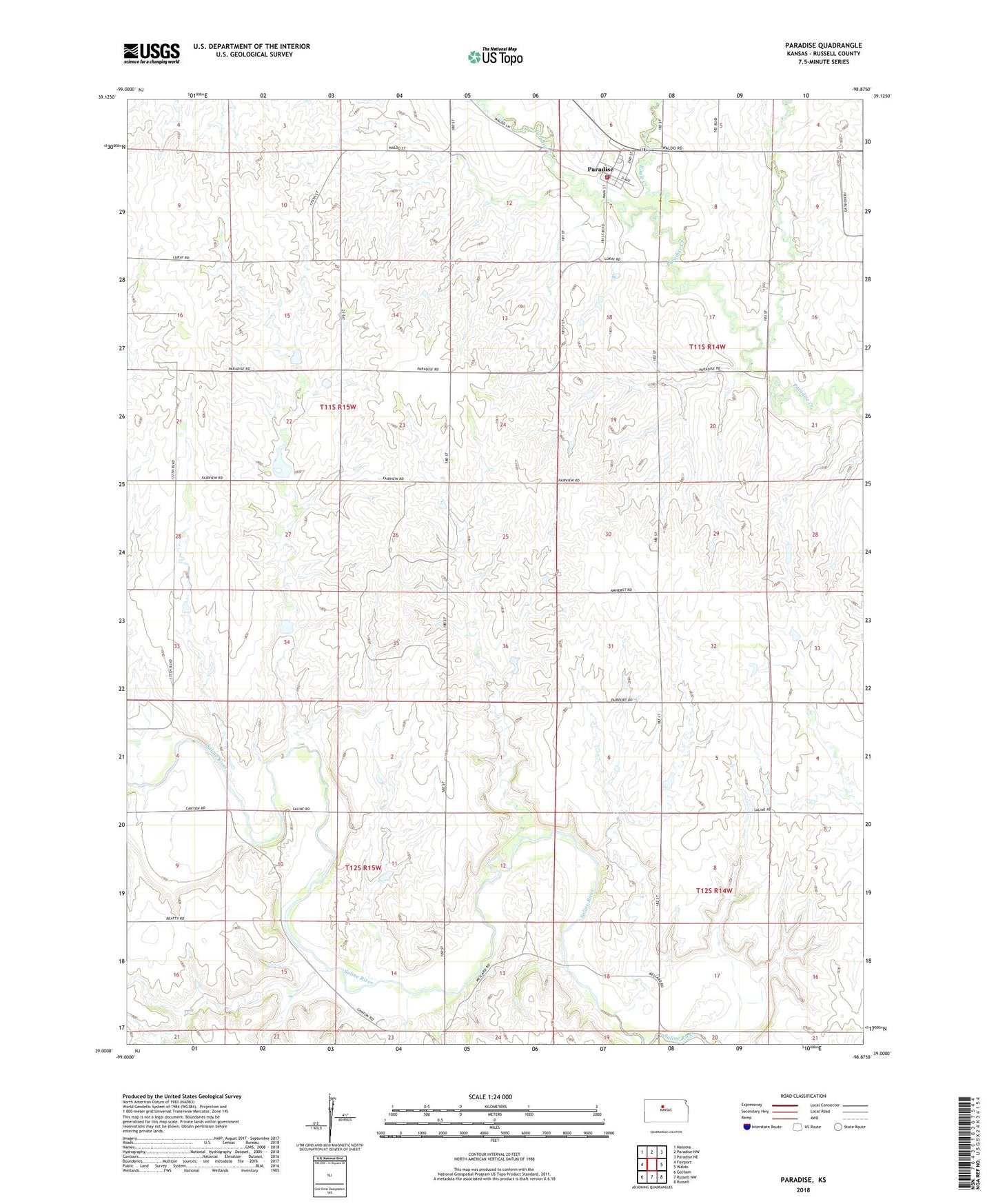
2022 topographic map quadrangle Paradise in the state of Kansas. Scale: 1:24000. Based on the newly updated USGS 7.5' US Topo map series, this map is in the following counties: Russell. The map contains contour data, water features, and other items you are used to seeing on USGS maps, but also has updated roads and other features. This is the next generation of topographic maps. Printed on high-quality waterproof paper with UV fade-resistant inks.
Quads adjacent to this one:
West: Fairport
Northwest: Natoma
North: Paradise NW
Northeast: Paradise NE
East: Waldo
Southeast: Russell
South: Russell NW
Southwest: Gorham
This map covers the same area as the classic USGS quad with code o39098a8.
Contains the following named places: City of Paradise, Eagle Creek, Fay, Jack, Paradise, Paradise Elementary School, Paradise Grain Company Grain Elevator Number 1, Paradise Post Office, Paradise Rural Fire District 3, Paradise United Methodist Church, Paradise Wastewater Plant, Township of Paradise, ZIP Code: 67658