MyTopo
Ransom Kansas US Topo Map
Couldn't load pickup availability
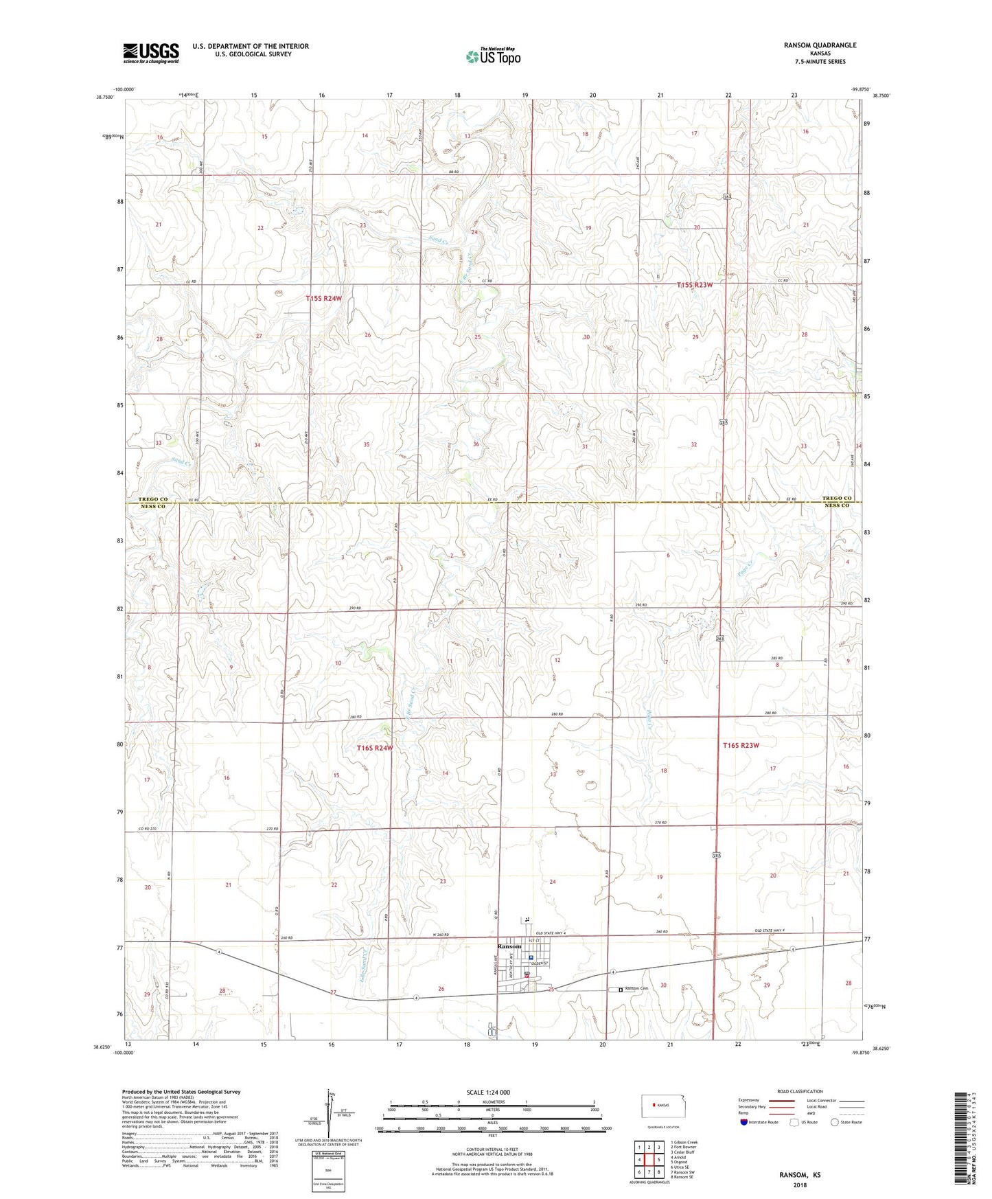
2022 topographic map quadrangle Ransom in the state of Kansas. Scale: 1:24000. Based on the newly updated USGS 7.5' US Topo map series, this map is in the following counties: Ness, Trego. The map contains contour data, water features, and other items you are used to seeing on USGS maps, but also has updated roads and other features. This is the next generation of topographic maps. Printed on high-quality waterproof paper with UV fade-resistant inks.
Quads adjacent to this one:
West: Arnold
Northwest: Gibson Creek
North: Fort Downer
Northeast: Cedar Bluff
East: Osgood
Southeast: Ransom SE
South: Ransom SW
Southwest: Utica SE
This map covers the same area as the classic USGS quad with code o38099f8.
Contains the following named places: Church of Christ, City of Ransom, East Branch Sand Creek, Grisell Memorial Hospital, North Ness County Emergency Medical Services, Pageton, Ransom, Ransom / Nevada Township Fire District, Ransom Cemetery, Ransom City Hall, Ransom Junior High School, Ransom Post Office, Ransom Public Library, Ransom Sewer Treatment Plant, Ransom United Methodist Church, Township of Nevada, Western Plains High School, Western Plains North Elementary School, ZIP Code: 67572