MyTopo
Russell Springs Kansas US Topo Map
Couldn't load pickup availability
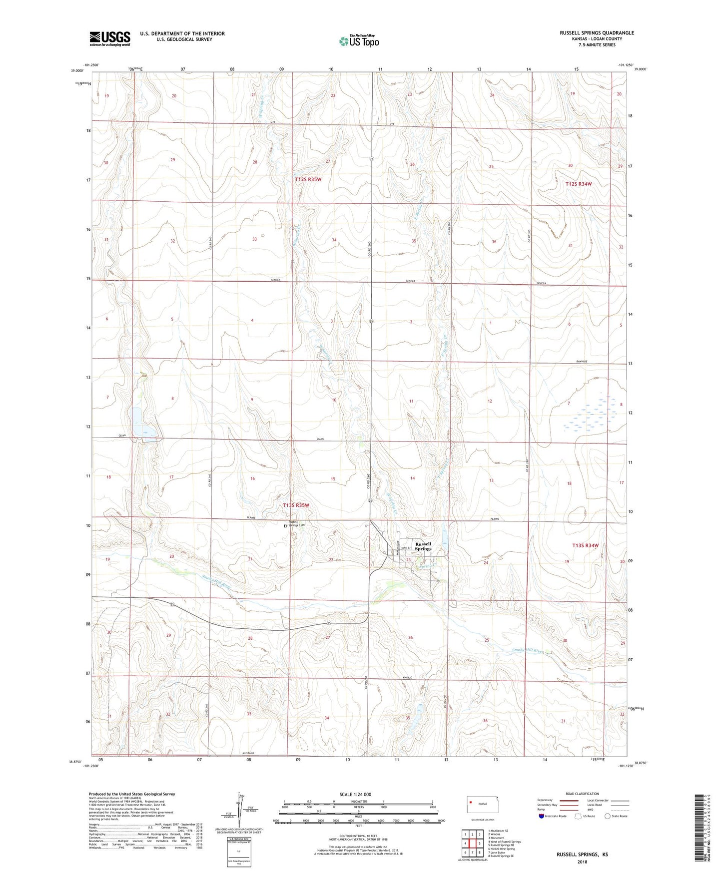
2022 topographic map quadrangle Russell Springs in the state of Kansas. Scale: 1:24000. Based on the newly updated USGS 7.5' US Topo map series, this map is in the following counties: Logan. The map contains contour data, water features, and other items you are used to seeing on USGS maps, but also has updated roads and other features. This is the next generation of topographic maps. Printed on high-quality waterproof paper with UV fade-resistant inks.
Quads adjacent to this one:
West: West of Russell Springs
Northwest: McAllaster SE
North: Winona
Northeast: Monument
East: Russell Springs NE
Southeast: Russell Springs SE
South: Lone Butte
Southwest: Nickel Mine Spring
This map covers the same area as the classic USGS quad with code o38101h2.
Contains the following named places: Butterfield Trail Museum and Historical Museum, City of Russell Springs, East Spring Creek, Logan County, Logan County State Lake Dam, Logan County State Park, Logan State Fishing Lake and Wildlife Area, Russell Springs, Russell Springs Cemetery, Russell Springs Dam, Saint Francis Episcopal Church, Spring Creek, Township of Russell Springs, West Spring Creek, ZIP Code: 67764