MyTopo
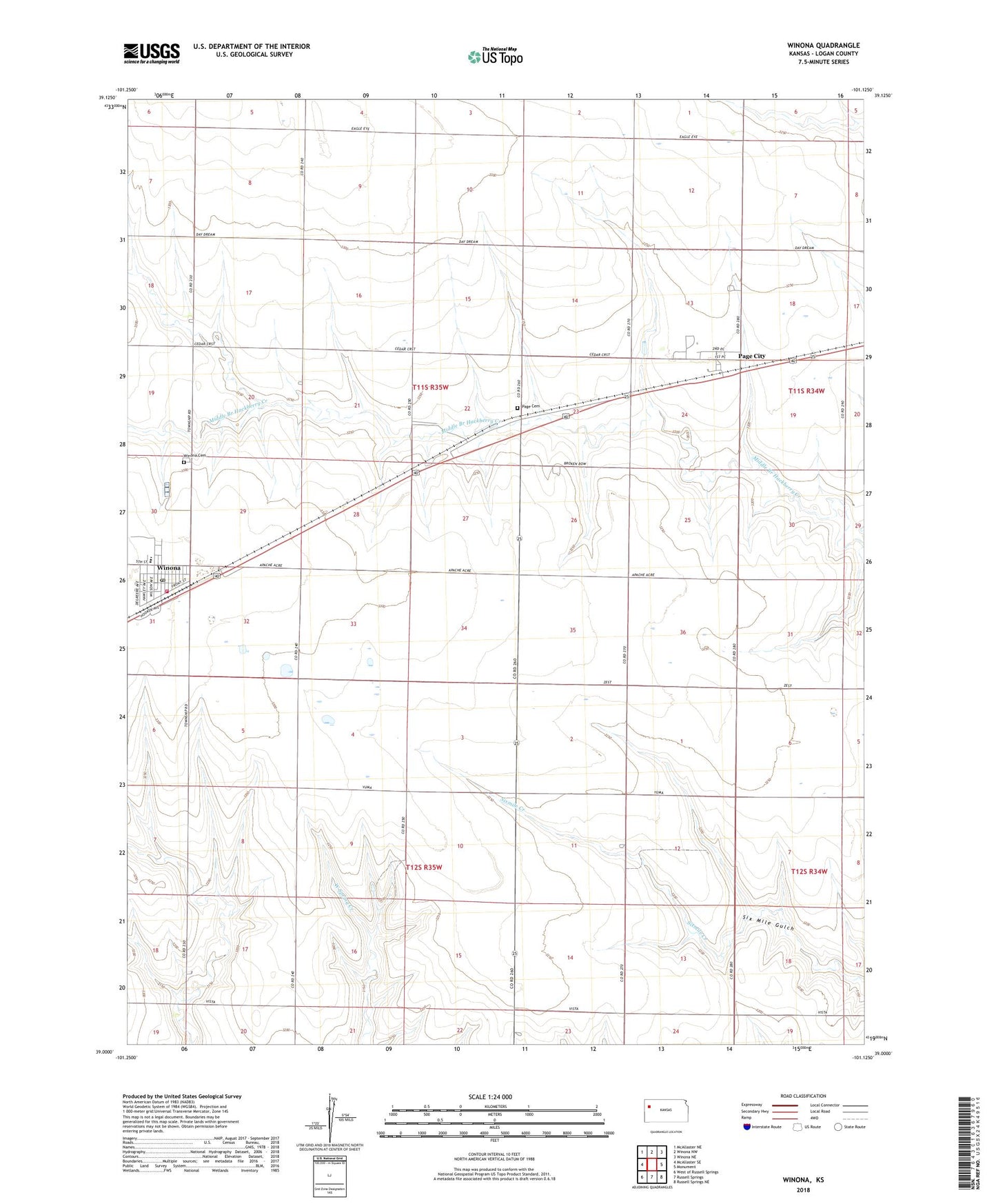
Winona Kansas US Topo Map
Couldn't load pickup availability
2022 topographic map quadrangle Winona in the state of Kansas. Scale: 1:24000. Based on the newly updated USGS 7.5' US Topo map series, this map is in the following counties: Logan. The map contains contour data, water features, and other items you are used to seeing on USGS maps, but also has updated roads and other features. This is the next generation of topographic maps. Printed on high-quality waterproof paper with UV fade-resistant inks.
Quads adjacent to this one:
West: McAllaster SE
Northwest: McAllaster NE
North: Winona NW
Northeast: Winona NE
East: Monument
Southeast: Russell Springs NE
South: Russell Springs
Southwest: West of Russell Springs
This map covers the same area as the classic USGS quad with code o39101a2.
Contains the following named places: Bethesda Lutheran Church, City of Winona, First United Methodist Church of Winona, Frontier Agricultural Grain Elevator Number 12, Frontier Agricultural Grain Elevator Number 9, Keller Brothers Landing Strip, Page City, Page City Cemetery, Township of Winona, Winona, Winona Cemetery, Winona Elementary School, Winona Emergency Medical Services, Winona Feed and Grain Elevator Number 1, Winona Fire Department, Winona High School, Winona Post Office, Winona Wastewater Plant