MyTopo
Satanta Kansas US Topo Map
Couldn't load pickup availability
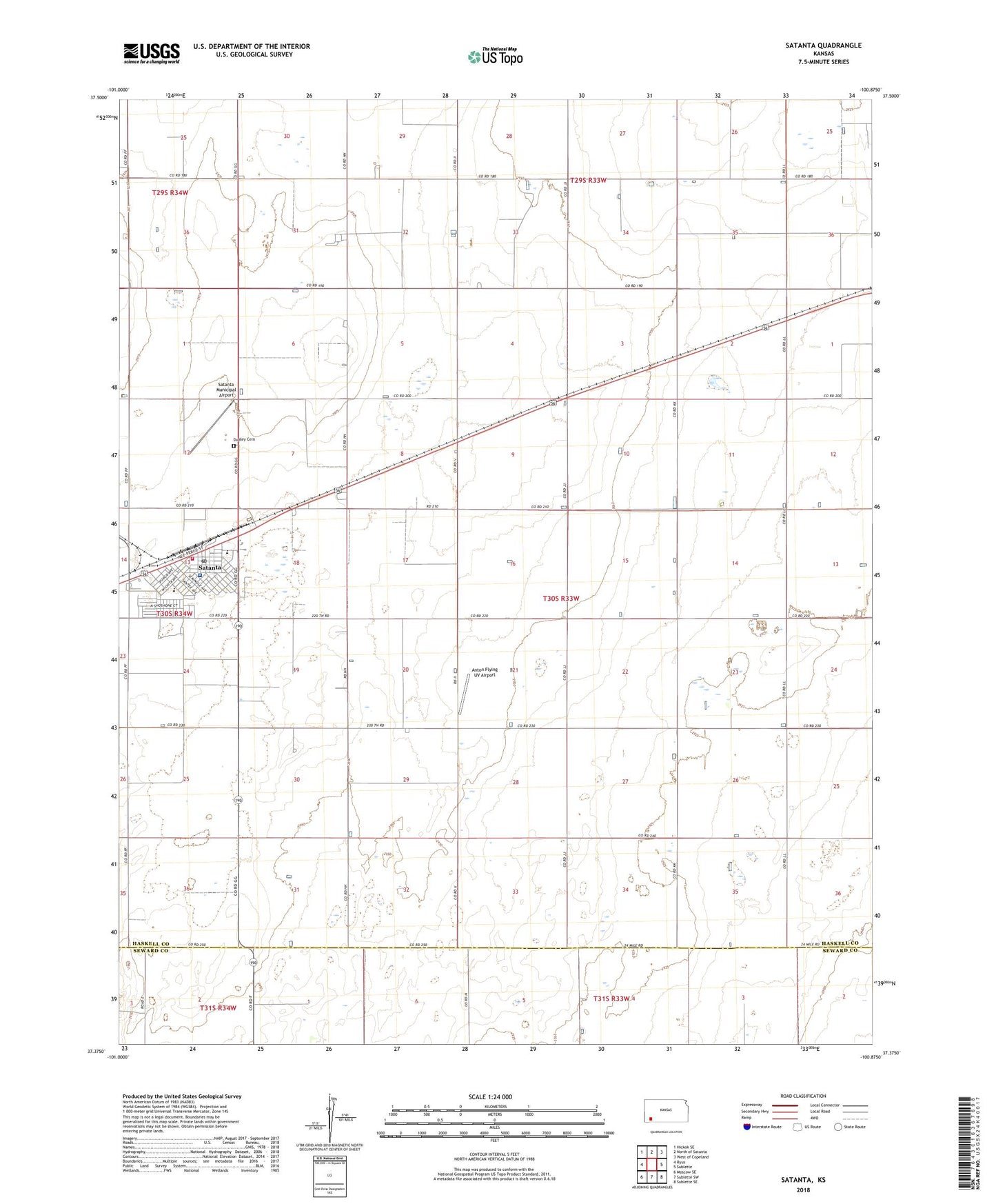
2022 topographic map quadrangle Satanta in the state of Kansas. Scale: 1:24000. Based on the newly updated USGS 7.5' US Topo map series, this map is in the following counties: Haskell, Seward. The map contains contour data, water features, and other items you are used to seeing on USGS maps, but also has updated roads and other features. This is the next generation of topographic maps. Printed on high-quality waterproof paper with UV fade-resistant inks.
Quads adjacent to this one:
West: Ryus
Northwest: Hickok SE
North: North of Satanta
Northeast: West of Copeland
East: Sublette
Southeast: Sublette SE
South: Sublette SW
Southwest: Moscow SE
This map covers the same area as the classic USGS quad with code o37100d8.
Contains the following named places: Anton Flying UV Airport, Church of Christ, City of Satanta, Dudley Cemetery, Dudley Township Library, First Baptist Church, First United Pentecostal Church, Haskell County Ambulance Satanta Station, Lemon Northeast Oil Field, Saint Alphonsus Catholic Church, Satanta, Satanta and Dudley Township Fire Department, Satanta City Hall, Satanta District Hospital, Satanta Grade School, Satanta Happy Agers Center, Satanta Junior / Senior High School, Satanta Municipal Airport, Satanta Post Office, Satanta United Methodist Church, Victory Oil and Gas Field