MyTopo
Skiddy Kansas US Topo Map
Couldn't load pickup availability
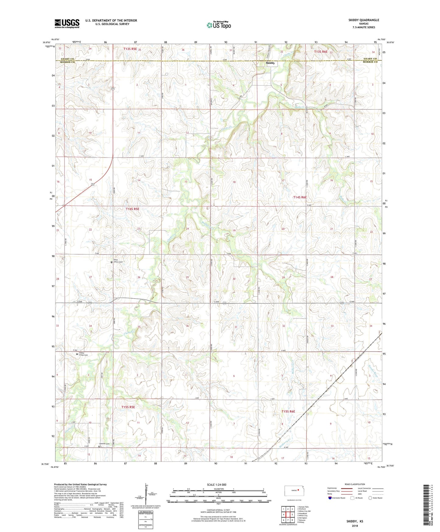
2022 topographic map quadrangle Skiddy in the state of Kansas. Scale: 1:24000. Based on the newly updated USGS 7.5' US Topo map series, this map is in the following counties: Morris, Geary. The map contains contour data, water features, and other items you are used to seeing on USGS maps, but also has updated roads and other features. This is the next generation of topographic maps. Printed on high-quality waterproof paper with UV fade-resistant inks.
Quads adjacent to this one:
West: Woodbine
Northwest: Kansas Falls
North: Wreford
Northeast: White City NW
East: White City
Southeast: Wilsey
South: Delavan
Southwest: Herington
This map covers the same area as the classic USGS quad with code o38096g7.
Contains the following named places: Calling Winds Farm, Clarks Creek Cemetery, Herpich Farm, Kniebel Farms, Latimer Cemetery, Mulberry Creek, Ralls Creek, Saint John's Cemetery, Skiddy, Spring Creek Ranch, Stilwell Ranch, Township 5, Township of Overland, ZIP Code: 66872