MyTopo
Wilsey Kansas US Topo Map
Couldn't load pickup availability
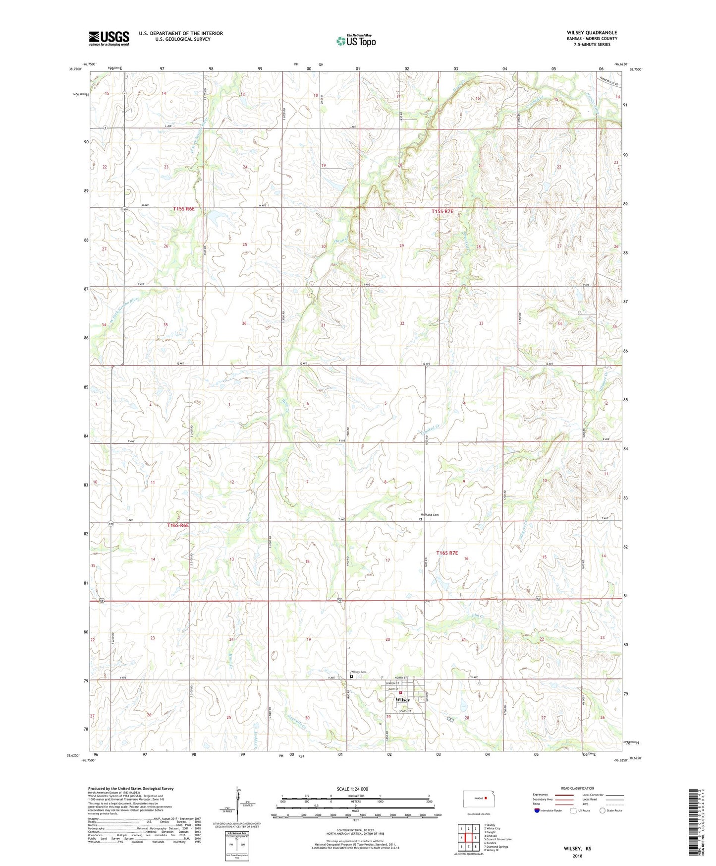
2022 topographic map quadrangle Wilsey in the state of Kansas. Scale: 1:24000. Based on the newly updated USGS 7.5' US Topo map series, this map is in the following counties: Morris. The map contains contour data, water features, and other items you are used to seeing on USGS maps, but also has updated roads and other features. This is the next generation of topographic maps. Printed on high-quality waterproof paper with UV fade-resistant inks.
Quads adjacent to this one:
West: Delavan
Northwest: Skiddy
North: White City
Northeast: Dwight
East: Council Grove Lake
Southeast: Wilsey SE
South: Diamond Springs
Southwest: Burdick
This map covers the same area as the classic USGS quad with code o38096f6.
Contains the following named places: City of Wilsey, Crooked Creek, Elm Creek Township Library, Highland Cemetery, Morris County, Patterson, Wilsey, Wilsey Cemetery, Wilsey Christian Church, Wilsey Fire Department, Wilsey United Methodist Church, Wilsey Wastewater Treatment Facility