MyTopo
Soldier Creek NW Kansas US Topo Map
Couldn't load pickup availability
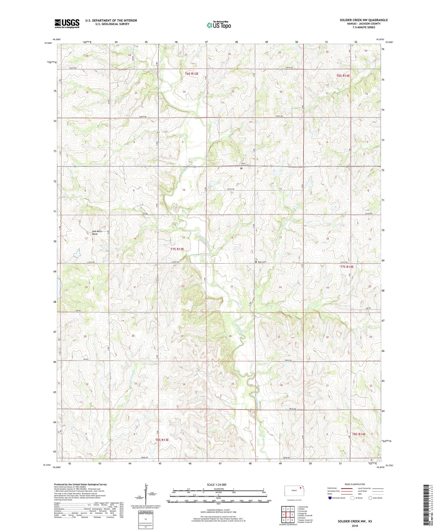
2022 topographic map quadrangle Soldier Creek NW in the state of Kansas. Scale: 1:24000. Based on the newly updated USGS 7.5' US Topo map series, this map is in the following counties: Jackson. The map contains contour data, water features, and other items you are used to seeing on USGS maps, but also has updated roads and other features. This is the next generation of topographic maps. Printed on high-quality waterproof paper with UV fade-resistant inks.
Quads adjacent to this one:
West: Onaga NE
Northwest: Havensville
North: Soldier
Northeast: Circleville
East: Soldier Creek NE
Southeast: Soldier Creek SE
South: Soldier Creek SW
Southwest: Emmett
This map covers the same area as the classic USGS quad with code o39095d8.
Contains the following named places: Boan Cemetery, Cedar Hill School, James Crossing, Little Plum Creek, Oak Mills Bend, Olive Hill Cemetery, Sunny Slope School, Township of Grant, ZIP Code: 66540