MyTopo
Soldier Creek SW Kansas US Topo Map
Couldn't load pickup availability
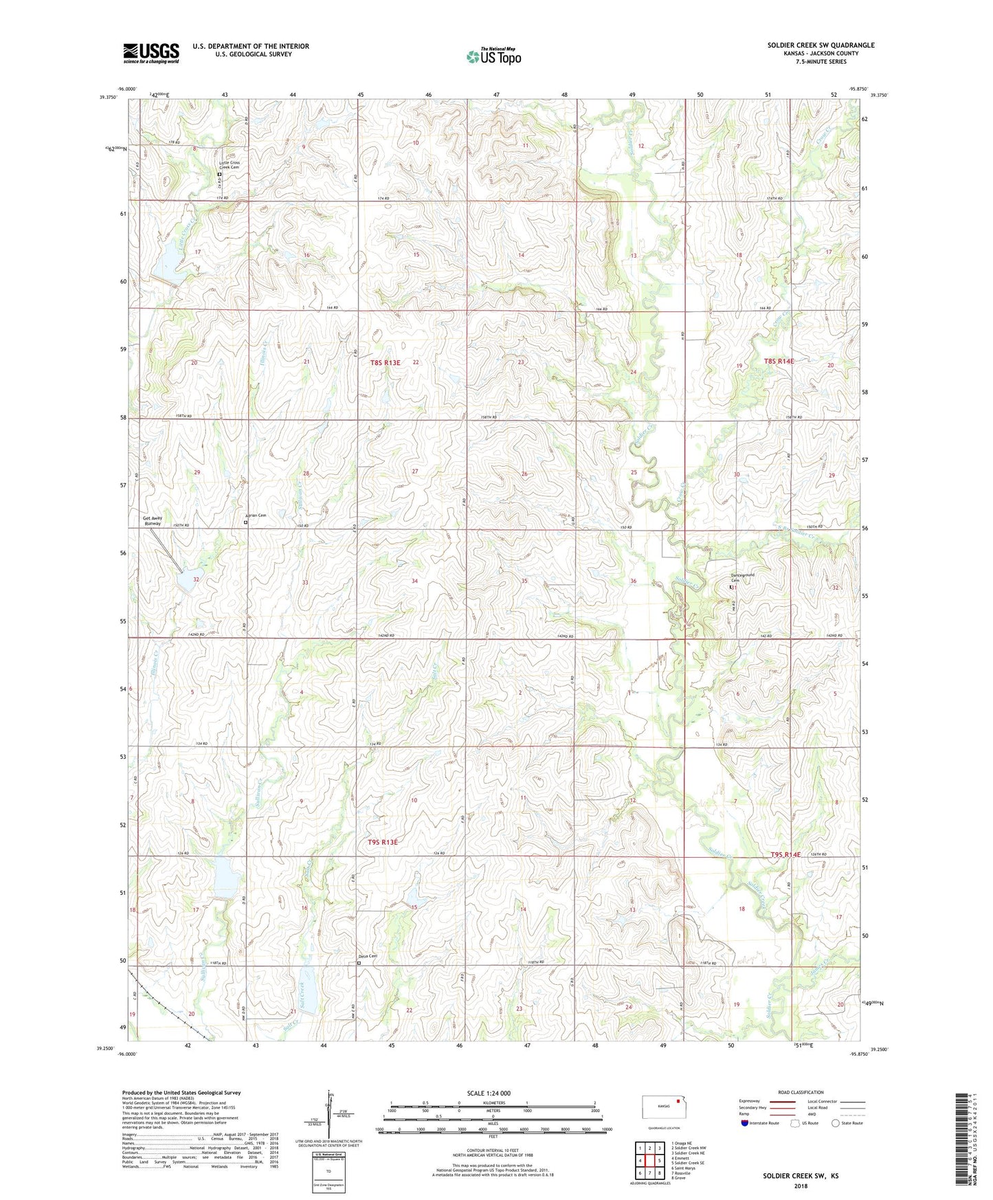
2022 topographic map quadrangle Soldier Creek SW in the state of Kansas. Scale: 1:24000. Based on the newly updated USGS 7.5' US Topo map series, this map is in the following counties: Jackson. The map contains contour data, water features, and other items you are used to seeing on USGS maps, but also has updated roads and other features. This is the next generation of topographic maps. Printed on high-quality waterproof paper with UV fade-resistant inks.
Quads adjacent to this one:
West: Emmett
Northwest: Onaga NE
North: Soldier Creek NW
Northeast: Soldier Creek NE
East: Soldier Creek SE
Southeast: Grove
South: Rossville
Southwest: Saint Marys
This map covers the same area as the classic USGS quad with code o39095c8.
Contains the following named places: Adrian, Adrian Cemetery, Crow Creek, Danceground Cemetery, Delia Cemetery, Get Away Runway, James Creek, Little Cross Creek Cemetery, Our Lady of the Snows Catholic Church, South Branch Soldier Creek, The Prairie Band of Potawatomi Nation Reservation, Township of Adrian, Township of Washington, ZIP Code: 66418