MyTopo
Sylvia Kansas US Topo Map
Couldn't load pickup availability
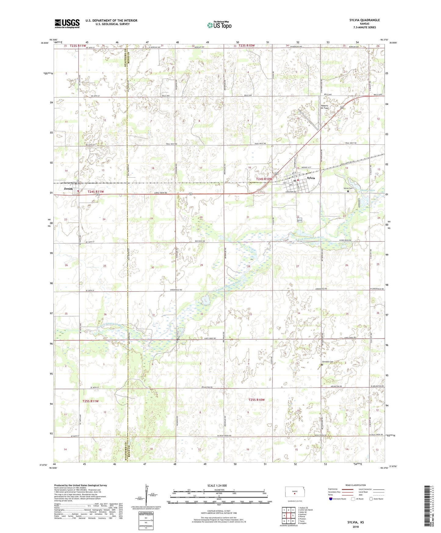
2022 topographic map quadrangle Sylvia in the state of Kansas. Scale: 1:24000. Based on the newly updated USGS 7.5' US Topo map series, this map is in the following counties: Reno, Stafford. The map contains contour data, water features, and other items you are used to seeing on USGS maps, but also has updated roads and other features. This is the next generation of topographic maps. Printed on high-quality waterproof paper with UV fade-resistant inks.
Quads adjacent to this one:
West: Stafford
Northwest: Hudson SE
North: Little Salt Marsh
Northeast: Alden SE
East: Plevna
Southeast: Langdon
South: Turon
Southwest: Preston
This map covers the same area as the classic USGS quad with code o37098h4.
Contains the following named places: Brownlee Lake, City of Sylvia, Fairfield West Elementary School, Glendale Cemetery, Hall Airfield, Hayes Airfield, Kanza Co - Operative Association Grain Elevator Number 10, Pleasant Hill Church of the Nazarene, Reno County Fire District 6 - Sylvia, Roberts Air Field, Stafford County Flour Mills Grain Elevator Number 3, Stafford County Rural Fire Department Station 460, Sunset Lakes, Sylvia, Sylvia Cemetery, Sylvia Church of Christ, Sylvia Post Office, Sylvia Public Library, Sylvia United Methodist Church, Sylvia Wastewater Plant, Township of Sylvia, Zenith, Zenith Community Church, Zenithscah Creek, ZIP Code: 67581