MyTopo
Timken Kansas US Topo Map
Couldn't load pickup availability
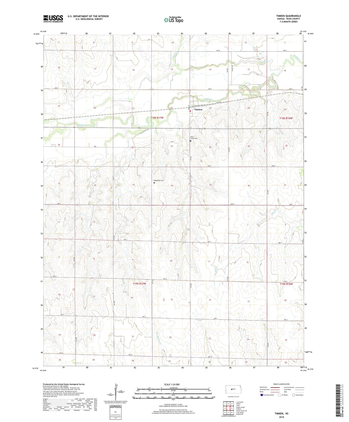
2022 topographic map quadrangle Timken in the state of Kansas. Scale: 1:24000. Based on the newly updated USGS 7.5' US Topo map series, this map is in the following counties: Rush. The map contains contour data, water features, and other items you are used to seeing on USGS maps, but also has updated roads and other features. This is the next generation of topographic maps. Printed on high-quality waterproof paper with UV fade-resistant inks.
Quads adjacent to this one:
West: Rush Center
Northwest: La Crosse
North: Bison
Northeast: Otis
East: Albert
Southeast: Albert SE
South: Ash Valley
Southwest: Rush Center SE
This map covers the same area as the classic USGS quad with code o38099d2.
Contains the following named places: Bohemian Cemetery, City of Timken, Holy Cross Cemetery, Holy Trinity Catholic Church, KBGL - FM (Albert), Mid - State Farmers Co - Operative Grain Elevator Number 6, Olney, Rush County Fire District 2 Timken, Sand Creek, Timken, Township of Banner