MyTopo
La Crosse Kansas US Topo Map
Couldn't load pickup availability
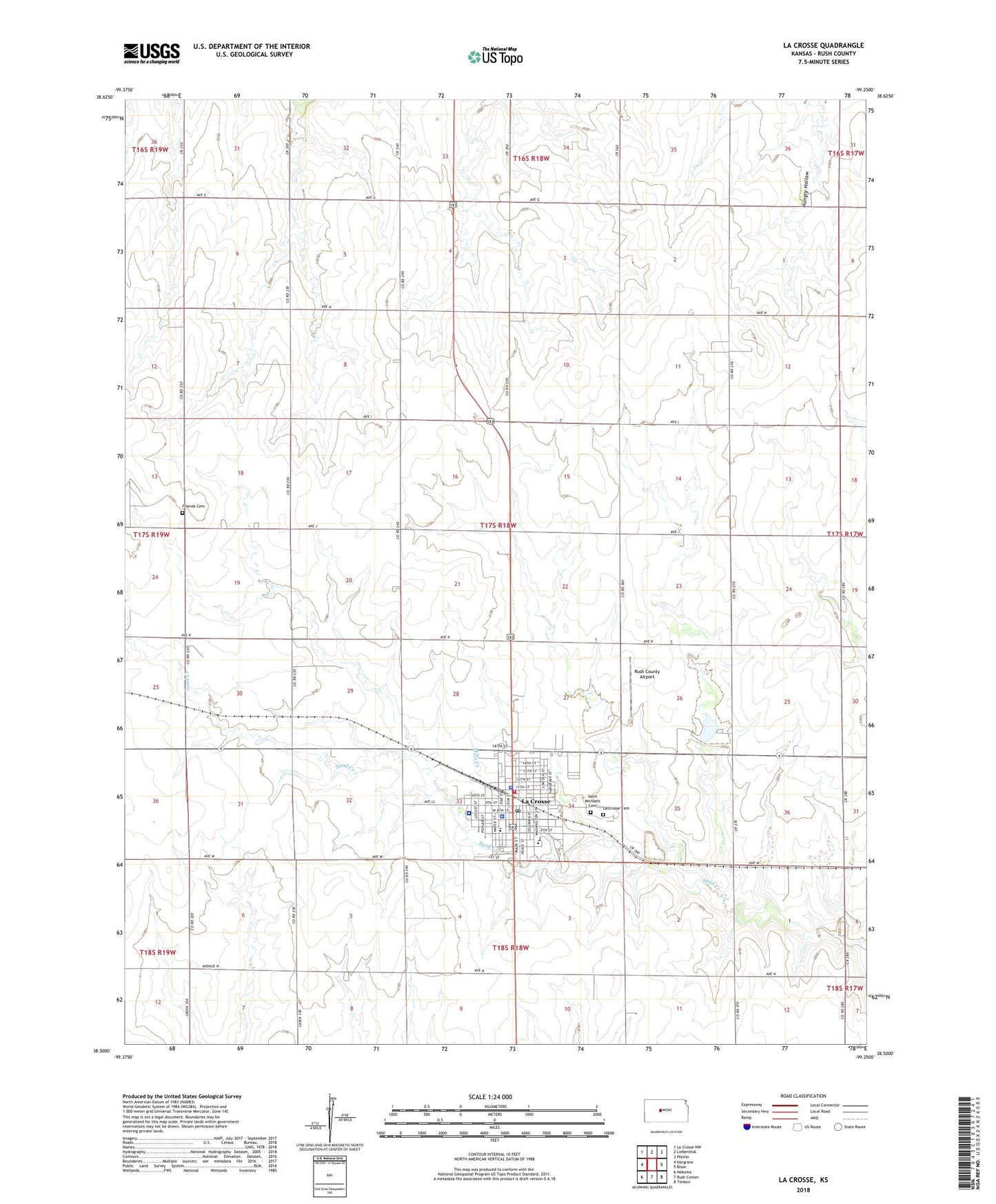
2022 topographic map quadrangle La Crosse in the state of Kansas. Scale: 1:24000. Based on the newly updated USGS 7.5' US Topo map series, this map is in the following counties: Rush. The map contains contour data, water features, and other items you are used to seeing on USGS maps, but also has updated roads and other features. This is the next generation of topographic maps. Printed on high-quality waterproof paper with UV fade-resistant inks.
Quads adjacent to this one:
West: Hargrave
Northwest: La Crosse NW
North: Liebenthal
Northeast: Pfeifer
East: Bison
Southeast: Timken
South: Rush Center
Southwest: Nekoma
This map covers the same area as the classic USGS quad with code o38099e3.
Contains the following named places: Barbed Wire Museum, Barnard Library, Central Rush County Emergency Medical Services, City of La Crosse, First Christian Church, First Lutheran Church, Friends Cemetery, Grass Park, Hoover Landing Field, Kansas Highway Patrol Troop E Rush, La Crosse, La Crosse Cemetery, La Crosse City Hall, La Crosse Country Club, La Crosse Municipal Power Plant, La Crosse Police Department, La Crosse Post Office, La Crosse Seventh Day Adventist Church, La Crosse United Methodist Church, La Crosse Wastewater Treatment Facility, Lacrosse Elementary School, Lacrosse High School, Lacrosse Middle School, Lippard, Mule Creek, Nekoma Bank Museum, New Covenant Fellowship, Post Rock Museum, Rush County, Rush County Airport, Rush County Courthouse, Rush County Fairgrounds, Rush County Fire District 4 La Crosse, Rush County Health Department, Rush County Historical Museum, Rush County Memorial Hospital, Rush County Sheriff's Office, Saint Michael's Catholic Church, Saint Michaels Cemetery, Sixty Plus Senior Center, Township of La Crosse-Brookdale, ZIP Code: 67548