MyTopo
Webber Kansas US Topo Map
Couldn't load pickup availability
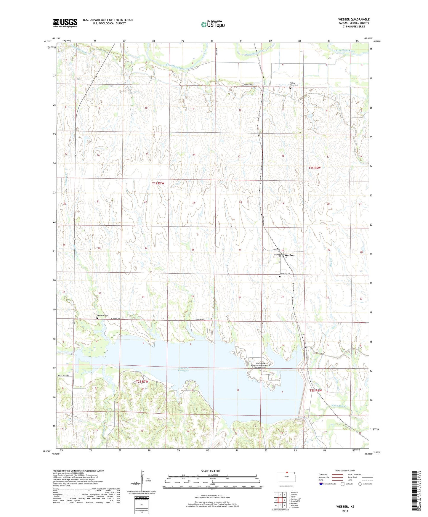
2022 topographic map quadrangle Webber in the state of Kansas. Scale: 1:24000. Based on the newly updated USGS 7.5' US Topo map series, this map is in the following counties: Jewell. The map contains contour data, water features, and other items you are used to seeing on USGS maps, but also has updated roads and other features. This is the next generation of topographic maps. Printed on high-quality waterproof paper with UV fade-resistant inks.
Quads adjacent to this one:
West: Mankato NW
Northwest: Bostwick
North: Superior
Northeast: Hardy
East: Scandia NW
Southeast: Courtland
South: Montrose
Southwest: Mankato
This map covers the same area as the classic USGS quad with code o39098h1.
Contains the following named places: Bishop, Cedar Point Recreation Area, City of Webber, Dahl Cemetery, Johns Creek, Lovewell Dam, Lovewell Reservoir, Lovewell State Park, Lovewell State Park Cedar Point Campground, Lovewell State Park Cottonwood Campground, Lovewell State Park Pioneer Campground, Lovewell State Park Walleye Point Campground, Lovewell State Park Willow Campground, Lovewell Wildlife Area, Montana Cemetery, Montana Creek, Oak Hill Recreation Area, Rubens, Township of Montana, Valley View Cemetery, Webber, Webber Cemetery, Webber Post Office, ZIP Code: 66970