MyTopo
Scandia NW Kansas US Topo Map
Couldn't load pickup availability
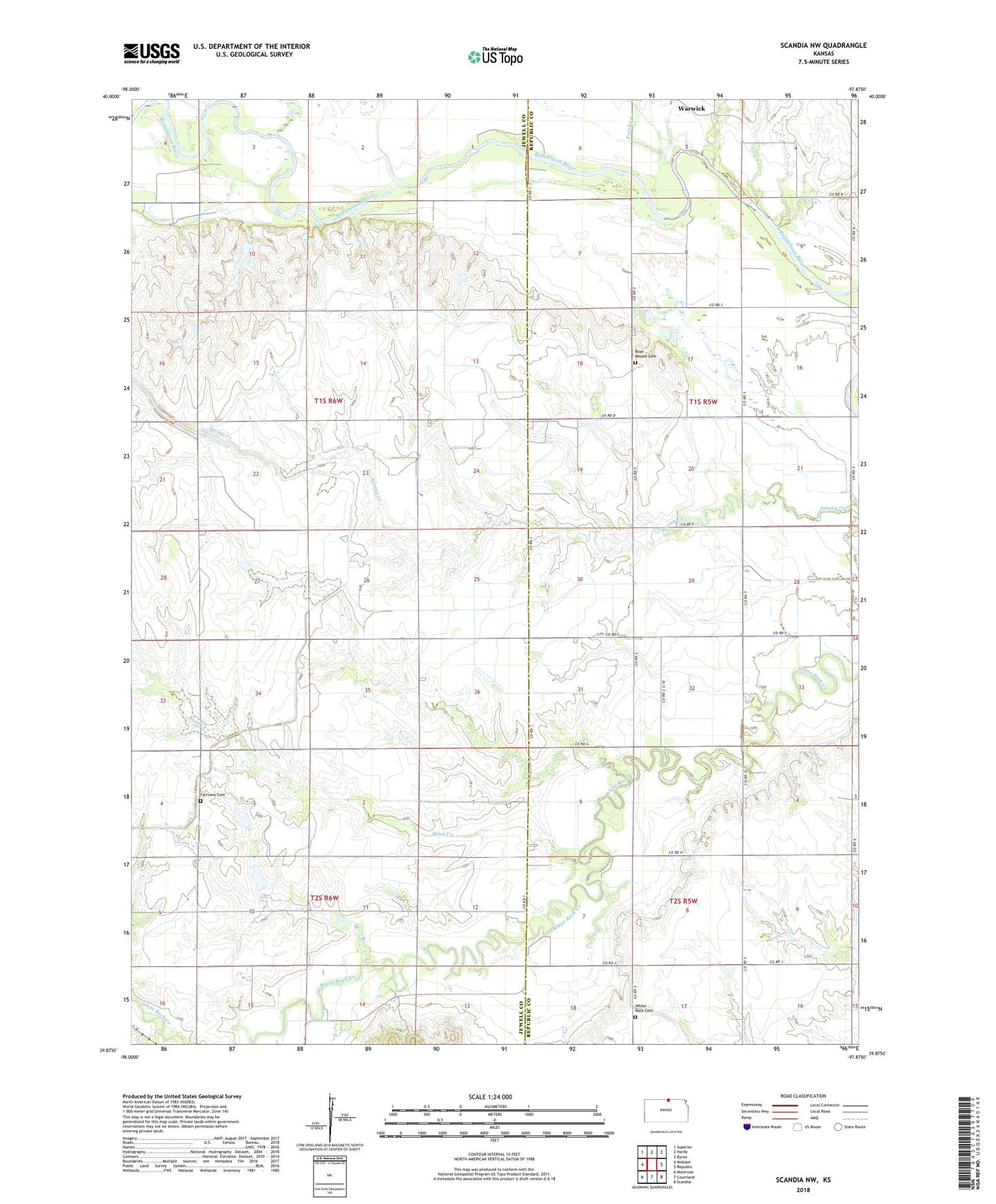
2022 topographic map quadrangle Scandia NW in the state of Kansas. Scale: 1:24000. Based on the newly updated USGS 7.5' US Topo map series, this map is in the following counties: Jewell, Republic. The map contains contour data, water features, and other items you are used to seeing on USGS maps, but also has updated roads and other features. This is the next generation of topographic maps. Printed on high-quality waterproof paper with UV fade-resistant inks.
Quads adjacent to this one:
West: Webber
Northwest: Superior
North: Hardy
Northeast: Byron
East: Republic
Southeast: Scandia
South: Courtland
Southwest: Montrose
This map covers the same area as the classic USGS quad with code o39097h8.
Contains the following named places: Bean Creek, Crosby Creek, Fairview Cemetery, Forsha Creek, North Canal, Rose Mound Cemetery, Township of Big Bend, Township of Jackson, Warwick, White Rock, White Rock Canal, White Rock Cemetery