MyTopo
Cowan Kentucky US Topo Map
Couldn't load pickup availability
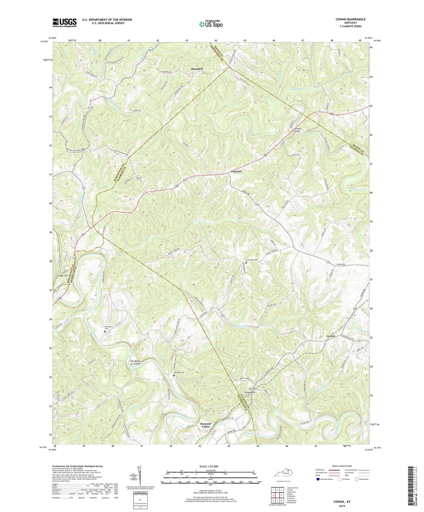
2022 topographic map quadrangle Cowan in the state of Kentucky. Scale: 1:24000. Based on the newly updated USGS 7.5' US Topo map series, this map is in the following counties: Fleming, Nicholas, Robertson, Mason. The map contains contour data, water features, and other items you are used to seeing on USGS maps, but also has updated roads and other features. This is the next generation of topographic maps. Printed on high-quality waterproof paper with UV fade-resistant inks.
Quads adjacent to this one:
West: Piqua
Northwest: Mount Olivet
North: Sardis
Northeast: Mays Lick
East: Elizaville
Southeast: Sherburne
South: Moorefield
Southwest: Carlisle
This map covers the same area as the classic USGS quad with code o38083d8.
Contains the following named places: Abner Post Office, Abners Mill, Absalom Creek, Alhambra, Alhambra Post Office, Baker Creek, Big Tunnel, Blue Licks Battlefield State Park, Blue Licks Spring, Buchanan Creek, Burika Post Office, Burika School, Cedar Hill, Cowan, Cowan Post Office, Cowan Railroad Station, Daton Chapel, Deer Lick School, Elk Creek, Evans Mills, Fairview, Fairview School, Five Lick Creek, Flora Post Office, Furman Chapel, Goose Creek, Herndon Cemetery, Hildreth Church, Hildreth School, Hoovers Run, Indian Run, Johnson Bridge, Johnson Creek Covered Bridge, Licking Post Office, Lower Blue Licks, Mint Creek, Mount Pisgah Baptist Church, Mount Tabor Episcopal Methodist Church, Oakwood Church, Oakwood Post Office, Pleasant Ridge Church, Pleasant Valley, Pleasant Valley Mills, Pleasant Valley Post Office, Pleasant Valley Railroad Station, Plugtown Branch, Rag Branch, Snow Hill School, Standiford Cemetery, Stony Creek, Straight Creek, Sunnyside Cemetery, Tabor Branch, Tea Run, The Bend of Licking, Tunnel Hill, Tunnel Hill School