MyTopo
Elizaville Kentucky US Topo Map
Couldn't load pickup availability
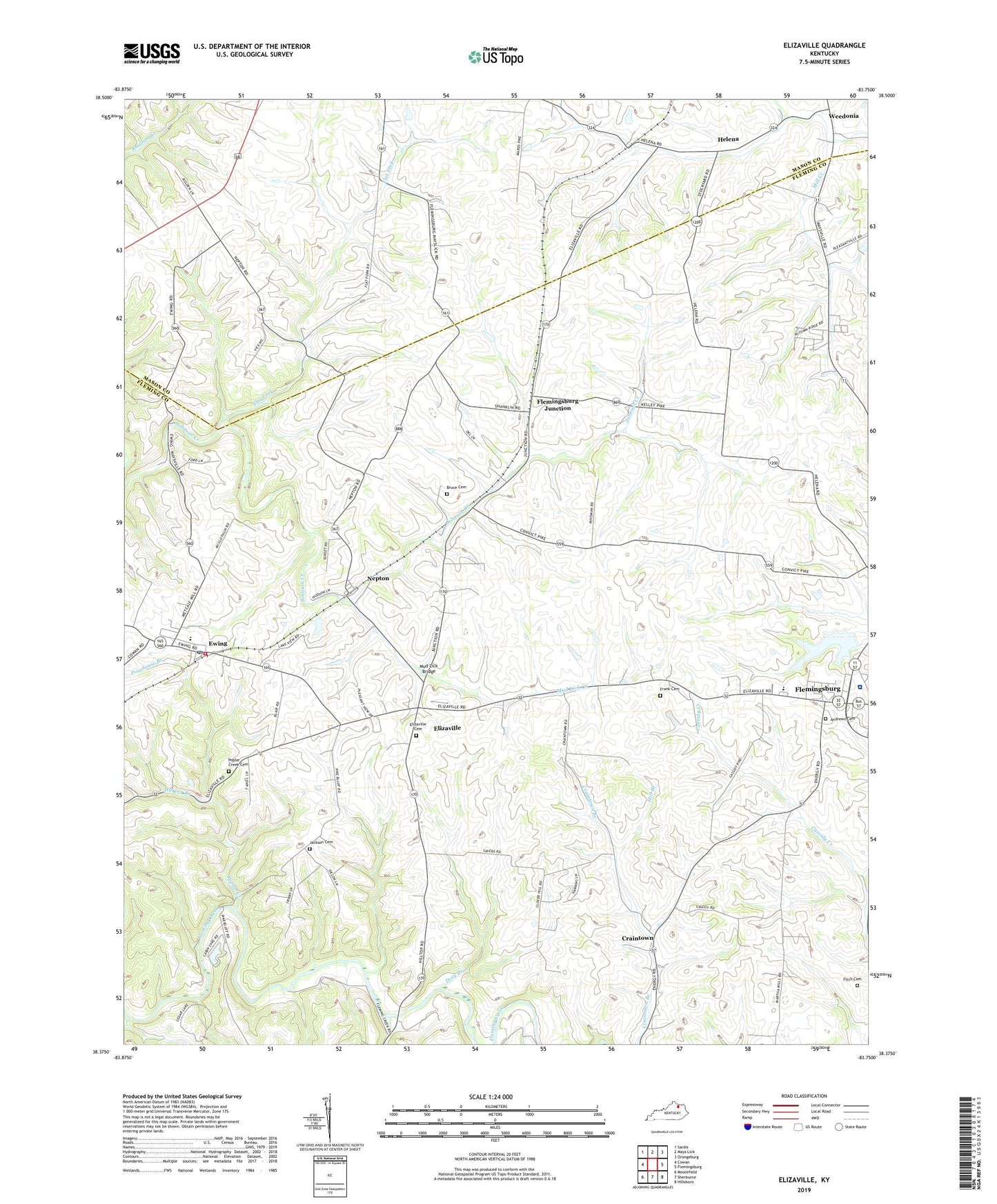
2022 topographic map quadrangle Elizaville in the state of Kentucky. Scale: 1:24000. Based on the newly updated USGS 7.5' US Topo map series, this map is in the following counties: Fleming, Mason. The map contains contour data, water features, and other items you are used to seeing on USGS maps, but also has updated roads and other features. This is the next generation of topographic maps. Printed on high-quality waterproof paper with UV fade-resistant inks.
Quads adjacent to this one:
West: Cowan
Northwest: Sardis
North: Mays Lick
Northeast: Orangeburg
East: Flemingsburg
Southeast: Hillsboro
South: Sherburne
Southwest: Moorefield
This map covers the same area as the classic USGS quad with code o38083d7.
Contains the following named places: Andrews Cemetery, Bethel School, Bruce Cemetery, Charles Young Birthplace Historical Marker, City of Ewing, Clover Hill Church, Crains Post Office, Craintown, Doty Branch, Elizaville, Elizaville Cemetery, Elizaville Census Designated Place, Elizaville Post Office, Ewing, Ewing Division, Ewing Fairgrounds, Ewing Post Office, Ewing Railroad Station, Ewing Volunteer Fire Department, Fitch Cemetery, Flat Fork, Fleming County High School, Fleming County Hospital, Flemingsburg Junction, Frank Cemetery, Franklin Runyon Sousley Historical Marker, Harper Branch, Helena, Hill Branch, Jackson Cemetery, John Hunt Morgans Last Raid Historical Marker, Johnson Junction Post Office, Michael Cassidy Historical Marker, Morgans Last Raid Historical Marker, Mud Lick Bridge, Mud Lick Creek, Nepton, Nepton Post Office, Nepton Railroad Station, Poorhouse Branch, Poplar Creek, Poplar Creek Cemetery, Poplar Run School, Private Ambers Sapp Historical Marker, School Number Thirty-five, Weedonia, ZIP Code: 41039