MyTopo
East Fork Kentucky US Topo Map
Couldn't load pickup availability
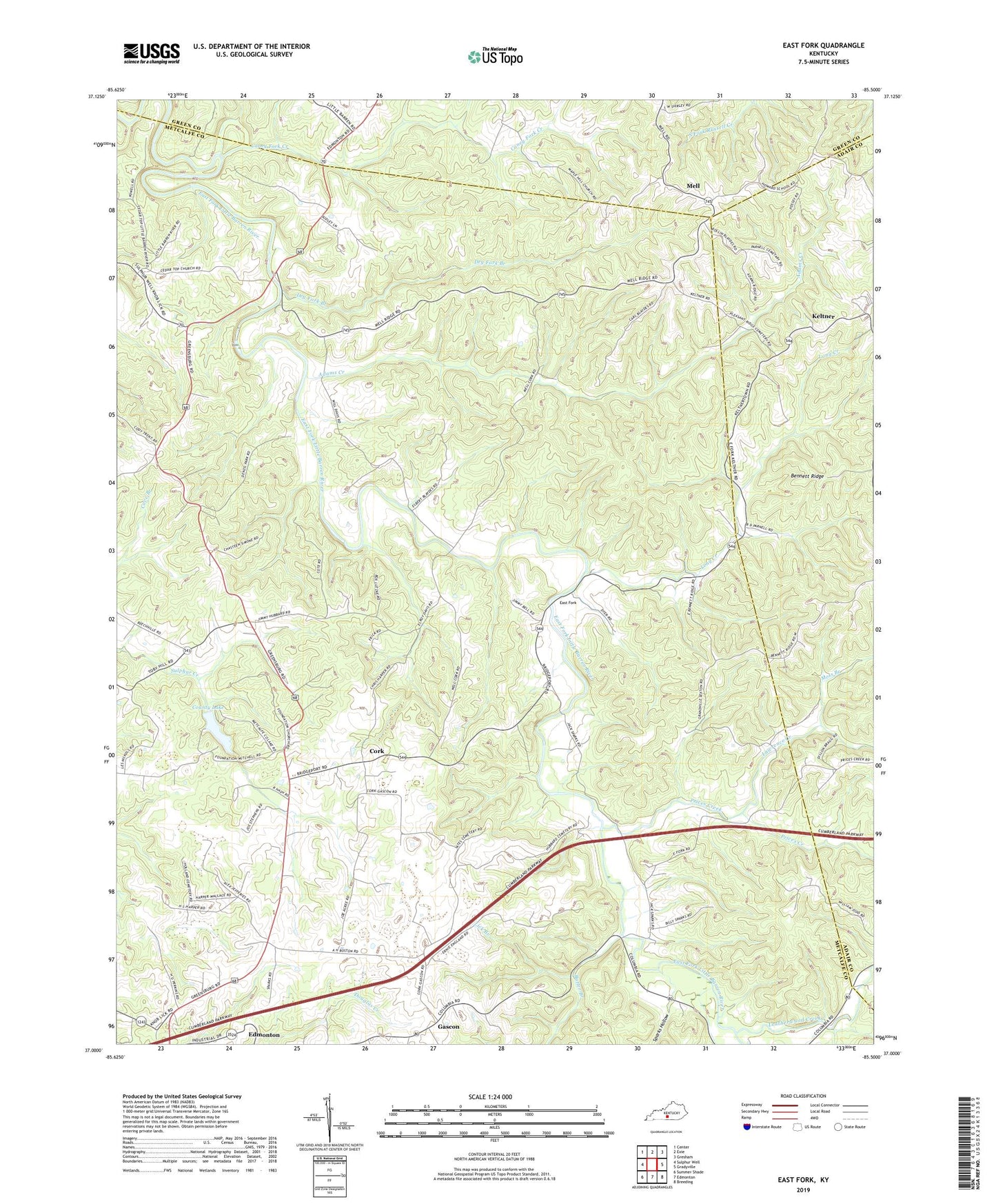
2022 topographic map quadrangle East Fork in the state of Kentucky. Scale: 1:24000. Based on the newly updated USGS 7.5' US Topo map series, this map is in the following counties: Metcalfe, Adair, Green. The map contains contour data, water features, and other items you are used to seeing on USGS maps, but also has updated roads and other features. This is the next generation of topographic maps. Printed on high-quality waterproof paper with UV fade-resistant inks.
Quads adjacent to this one:
West: Sulphur Well
Northwest: Center
North: Exie
Northeast: Gresham
East: Gradyville
Southeast: Breeding
South: Edmonton
Southwest: Summer Shade
This map covers the same area as the classic USGS quad with code o37085a5.
Contains the following named places: Adams Creek, Bennett Ridge, Butler Branch, Caney Fork Creek, Cedar Top Church, Cork, County Lake, Dry Fork Branch, East Fork, East Fork Church, Foundation Church, Gascon, Keltner, Lawrence Creek, Leatherwood Creek, Lick Branch, Long Creek, Maple Hill Church, Mell, Moss Branch, Penick Church, Pink Ridge Church, Pleasant Ridge United Methodist Church, Prices Creek, Prices Creek Church, Society Hill Church, Sparks Hollow, Union Chapel, WKNK-FM (Edmonton)