MyTopo
Sulphur Well Kentucky US Topo Map
Couldn't load pickup availability
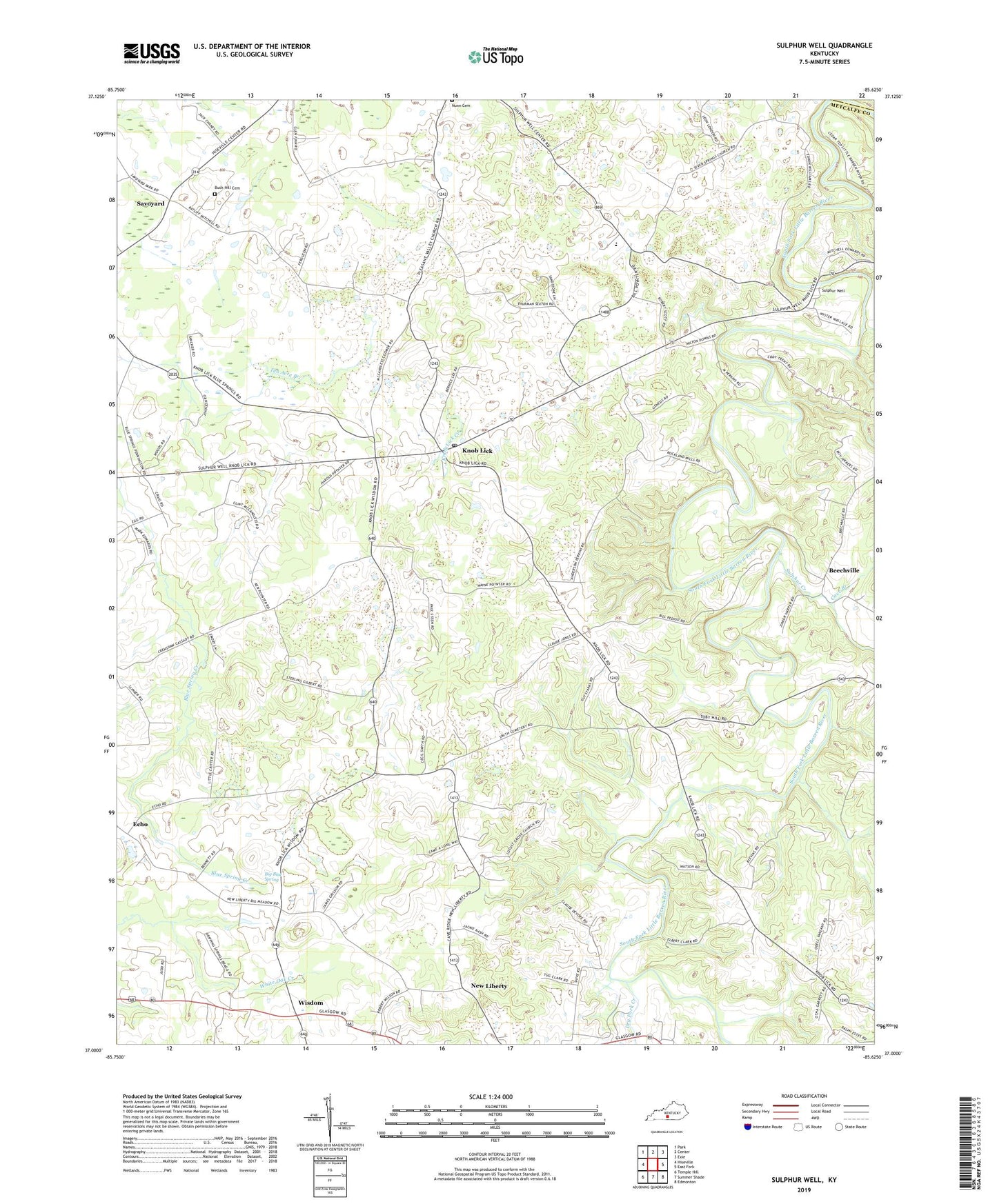
2022 topographic map quadrangle Sulphur Well in the state of Kentucky. Scale: 1:24000. Based on the newly updated USGS 7.5' US Topo map series, this map is in the following counties: Metcalfe, Green, Barren. The map contains contour data, water features, and other items you are used to seeing on USGS maps, but also has updated roads and other features. This is the next generation of topographic maps. Printed on high-quality waterproof paper with UV fade-resistant inks.
Quads adjacent to this one:
West: Hiseville
Northwest: Park
North: Center
Northeast: Exie
East: East Fork
Southeast: Edmonton
South: Summer Shade
Southwest: Temple Hill
This map covers the same area as the classic USGS quad with code o37085a6.
Contains the following named places: Antioch Church, Beechville, Bethlehem Church, Big Blue Spring, Buck Hill Cemetery, Cave Branch, Center Division, Clarks Corner, Dripping Spring Church, Dry Fork Creek, Ebenezer Church, Echo, Good Hope Church, Knob Lick, Knob Lick Creek, Knob Lick Post Office, Locust Grove Church, New Liberty, North Metcalfe Elementary School, Pleasant Valley Church, Savoyard, Seven Springs Cumberlanld Presbyterian Church, Sulphur Creek, Sulphur Well, Ten Acre Branch, Wisdom, Wisdom Cumberland Presbyterian Church, ZIP Code: 42154