MyTopo
Falmouth Kentucky US Topo Map
Couldn't load pickup availability
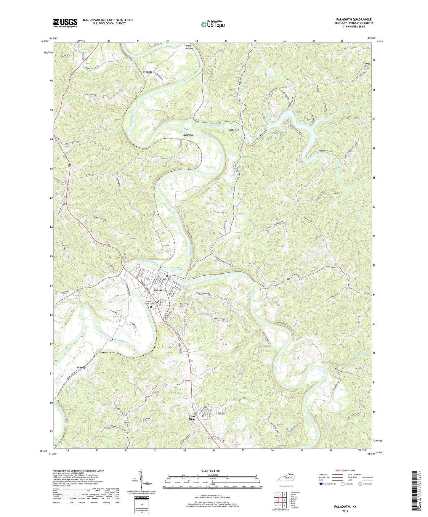
2022 topographic map quadrangle Falmouth in the state of Kentucky. Scale: 1:24000. Based on the newly updated USGS 7.5' US Topo map series, this map is in the following counties: Pendleton. The map contains contour data, water features, and other items you are used to seeing on USGS maps, but also has updated roads and other features. This is the next generation of topographic maps. Printed on high-quality waterproof paper with UV fade-resistant inks.
Quads adjacent to this one:
West: Goforth
Northwest: De Mossville
North: Butler
Northeast: Moscow
East: Berlin
Southeast: Claysville
South: Kelat
Southwest: Berry
This map covers the same area as the classic USGS quad with code o38084f3.
Contains the following named places: Antioch School, Beech Grove Cemetery, Blanket Creek, Bomors School, Bunker Hill, Catawba, Catawba Post Office, City of Falmouth, Concord, Concord School, County Almshouse Farm, Doole School, Falmouth, Falmouth Division, Falmouth Fire Department, Falmouth Police Department, Falmouth Post Office, Four Oaks, Four Oaks Post Office, Fredricksburg School, Galloway School, Grovers Creek, Hayes, Hayes Railroad Station, Hillsdale School, Irving Bottom, Johnson Creek, Kincaid Creek, Kincaid Lake, Kincaid Lake State Park, Levingood Post Office, Levingood School, Little Willow Creek, Menzie, Menzies Railroad Station, North Little Kincaid Creek, Pendleton County, Pendleton County Ambulance Service, Pendleton County Sheriff's Office, Penshurst Post Office, Rays Air Strip, Reservoir Hill, School Number Sixty-Six, Sins Crossing, South Fork Licking River, South Little Kincaid Creek, Steel Creek, Steer Creek, Thomas Hill, Turkey Branch, Uma Railroad Station, Wampum Post Office, Willow Creek, Wrights Station Post Office, ZIP Code: 41040