MyTopo
Claysville Kentucky US Topo Map
Couldn't load pickup availability
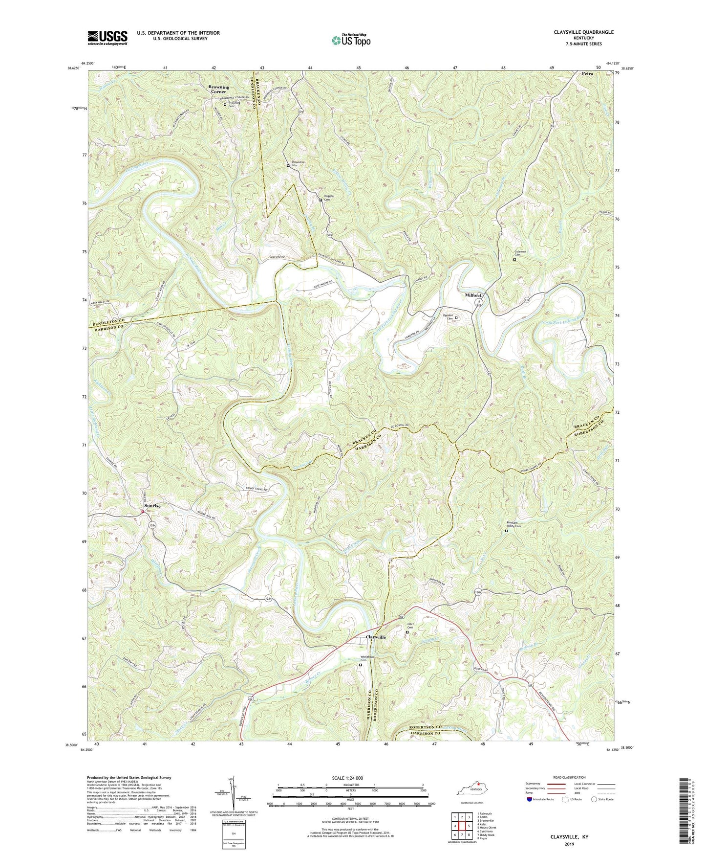
2022 topographic map quadrangle Claysville in the state of Kentucky. Scale: 1:24000. Based on the newly updated USGS 7.5' US Topo map series, this map is in the following counties: Bracken, Harrison, Robertson, Pendleton. The map contains contour data, water features, and other items you are used to seeing on USGS maps, but also has updated roads and other features. This is the next generation of topographic maps. Printed on high-quality waterproof paper with UV fade-resistant inks.
Quads adjacent to this one:
West: Kelat
Northwest: Falmouth
North: Berlin
Northeast: Brooksville
East: Mount Olivet
Southeast: Piqua
South: Shady Nook
Southwest: Cynthiana
This map covers the same area as the classic USGS quad with code o38084e2.
Contains the following named places: Aulick Post Office, Barlow Church, Beaver Creek, Browning Cemetery, Browning Corner, Charley Branch, Claysville, Coleman Branch, Coleman Cemetery, Doggett Cemetery, Ernst Post Office, Fallen Rock, Forest Grove School, Garrard Branch, Greasy Creek, Harrison County Volunteer Fire Department Station 6 Sunrise, Harrison Creek, Hitch Cemetery, Jackson Branch, Little Richland Creek, Milford, Milford Post Office, Milford School, Mill Creek, Mount Gilead Church, North Fork Licking River, Ogeden Cemetery, Petra, Pipe Creek, Pleasant Valley Cemetery, Poston Saw Mill, Richland Creek, Rush Branch, Sante Fe School, Showalter Cemetery, Stony Creek, Sunrise, The North Fork Baptist Church, Travelers Rest Post Office, West Creek, Whitehead Cemetery, Willow Baptist Church, Willow Creek, Yellow Willow Creek