MyTopo
Graham Kentucky US Topo Map
Couldn't load pickup availability
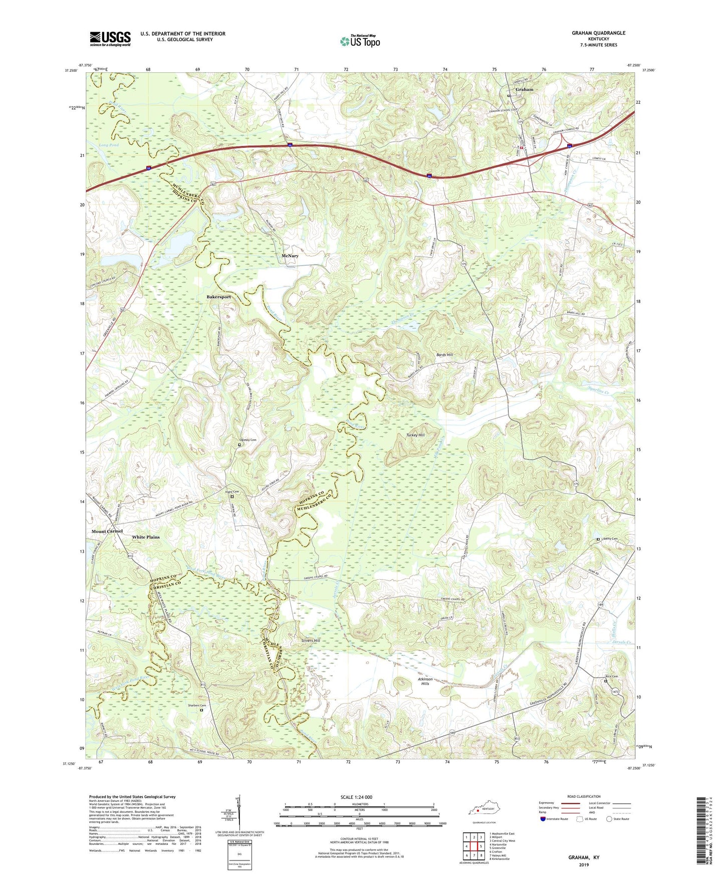
2022 topographic map quadrangle Graham in the state of Kentucky. Scale: 1:24000. Based on the newly updated USGS 7.5' US Topo map series, this map is in the following counties: Muhlenberg, Hopkins, Christian. The map contains contour data, water features, and other items you are used to seeing on USGS maps, but also has updated roads and other features. This is the next generation of topographic maps. Printed on high-quality waterproof paper with UV fade-resistant inks.
Quads adjacent to this one:
West: Nortonville
Northwest: Madisonville East
North: Millport
Northeast: Central City West
East: Greenville
Southeast: Kirkmansville
South: Haleys Mill
Southwest: Crofton
This map covers the same area as the classic USGS quad with code o37087b3.
Contains the following named places: Atkinson Hills, Bakersport, Bards Hill, Bards Hill Church, Cave Spring Church, Elk Pond Creek, Gordon, Graham Census Designated Place, Graham Post Office, Graham Volunteer Fire Department, Greens Chapel, Halls Creek, Hight Cemetery, Immanuel Church, Jarrells, Jarrels Creek, Liberty Cemetery, Long Pond, McFarland Creek, McNary, Mount Carmel, Number Five, Oglesby Cemetery, Rice Cemetery, Sharbers Cemetery, Spurlins Creek, Stivers Hill, Thompson Creek, Turkey Hill, Unity Church, Vernal Grove, Vernal Grove Church, West Fork Pond River, Yeargins Chapel, ZIP Code: 42464