MyTopo
Kirkmansville Kentucky US Topo Map
Couldn't load pickup availability
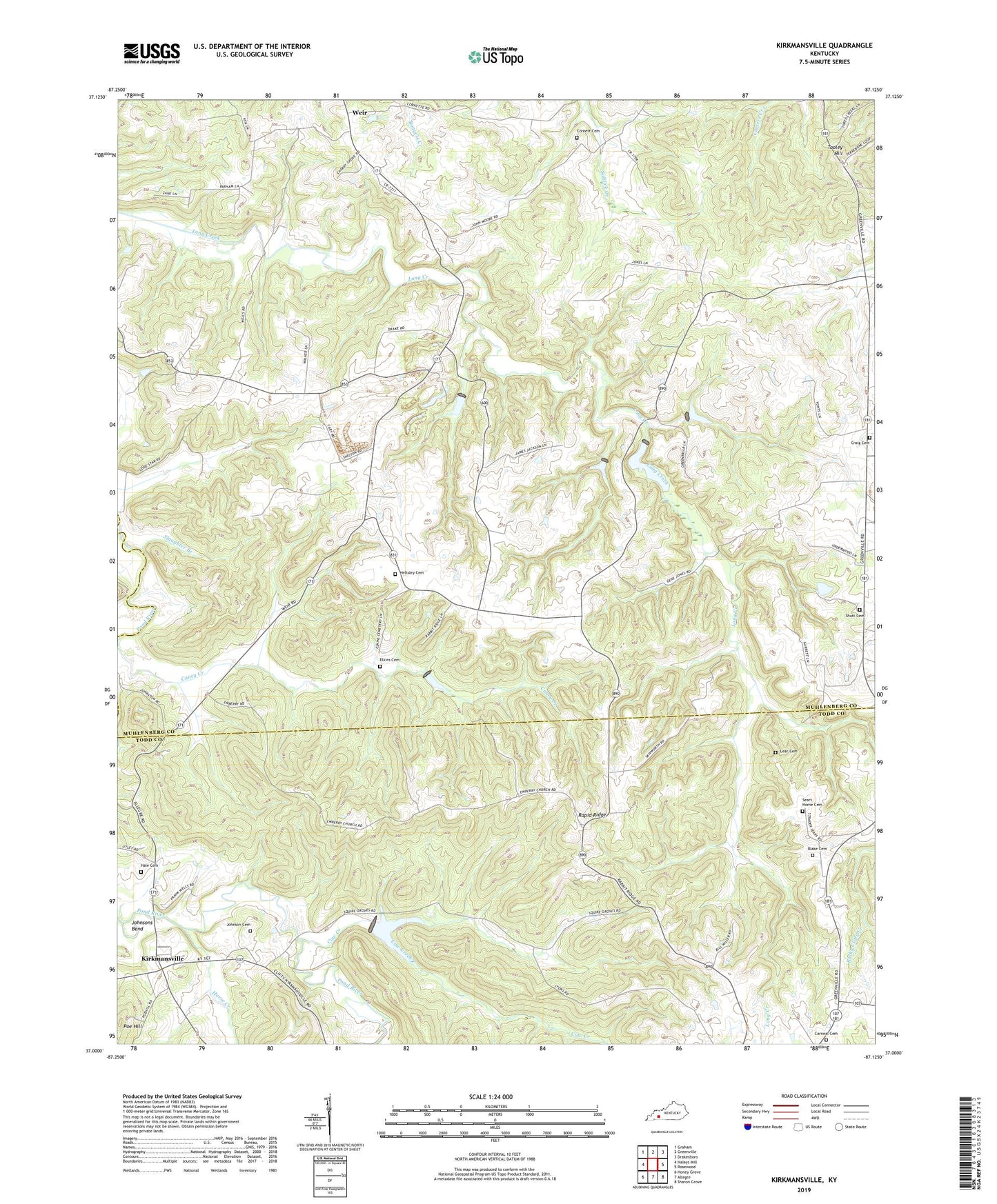
2022 topographic map quadrangle Kirkmansville in the state of Kentucky. Scale: 1:24000. Based on the newly updated USGS 7.5' US Topo map series, this map is in the following counties: Muhlenberg, Todd. The map contains contour data, water features, and other items you are used to seeing on USGS maps, but also has updated roads and other features. This is the next generation of topographic maps. Printed on high-quality waterproof paper with UV fade-resistant inks.
Quads adjacent to this one:
West: Haleys Mill
Northwest: Graham
North: Greenville
Northeast: Drakesboro
East: Rosewood
Southeast: Sharon Grove
South: Allegre
Southwest: Honey Grove
This map covers the same area as the classic USGS quad with code o37087a2.
Contains the following named places: Bivins, Blake Cemetery, Caney Creek, Carneal Cemetery, Cherry Grove Church, Cornett Cemetery, Cow Creek, Craig Cemetery, Dam Number 2, Dam Number 7C, Dam Number 9, Dam Number 9A, Dam Number 9B, Dam Number 9C, Elkins Cemetery, Emberry Church, Greenbriar, Greenbrier Church, Hale Cemetery, Heltsley Cemetery, Horse Creek, Johnson Cemetery, Johnsons Bend, Joines Church, Kirkmansville, Landmark Assembly Church, Lear Cemetery, Lone Star Church, Olive Grove Church, Poe Hill, Rapid Ridge, Rosewood Division, Sears Home Cemetery, Shutt Cemetery, Slaughter Branch, Tooley Hill, Weir