MyTopo
Herndon Kentucky US Topo Map
Couldn't load pickup availability
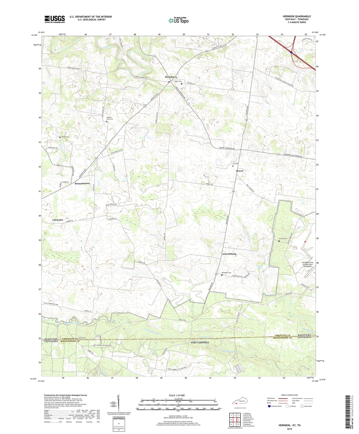
2022 topographic map quadrangle Herndon in the states of Kentucky, Tennessee. Scale: 1:24000. Based on the newly updated USGS 7.5' US Topo map series, this map is in the following counties: Christian, Montgomery. The map contains contour data, water features, and other items you are used to seeing on USGS maps, but also has updated roads and other features. This is the next generation of topographic maps. Printed on high-quality waterproof paper with UV fade-resistant inks.
Quads adjacent to this one:
West: Roaring Spring
Northwest: Caledonia
North: Church Hill
Northeast: Hopkinsville
East: Oak Grove
Southeast: New Providence
South: Woodlawn
Southwest: Indian Mound
Contains the following named places: Bennettstown, Campbell Army Airfield (Fort Campbell), Double Barn Cemetery, Douglas, Flat Lick, Flat Lick Church, Fort Campbell Department of Defense Fire Department Station 4, Fort Campbell Division, Fox Cemetery, Garrettsburg, Garrott Cemetery, Herndon, Herndon Post Office, Herndon Volunteer Fire Department, Howel, LaFayette, LaFayette Division, Major Cemetery, McGee Cemetery, McKenzie-Kirk Presbyterian Church, McKnight Cemetery, New Asia Church, Noahs Spring, Olivet Baptist Church, Quarles Spring, South Christian Elementary School, Stephenson, Zion Hope Church, ZIP Code: 42236