MyTopo
Caledonia Kentucky US Topo Map
Couldn't load pickup availability
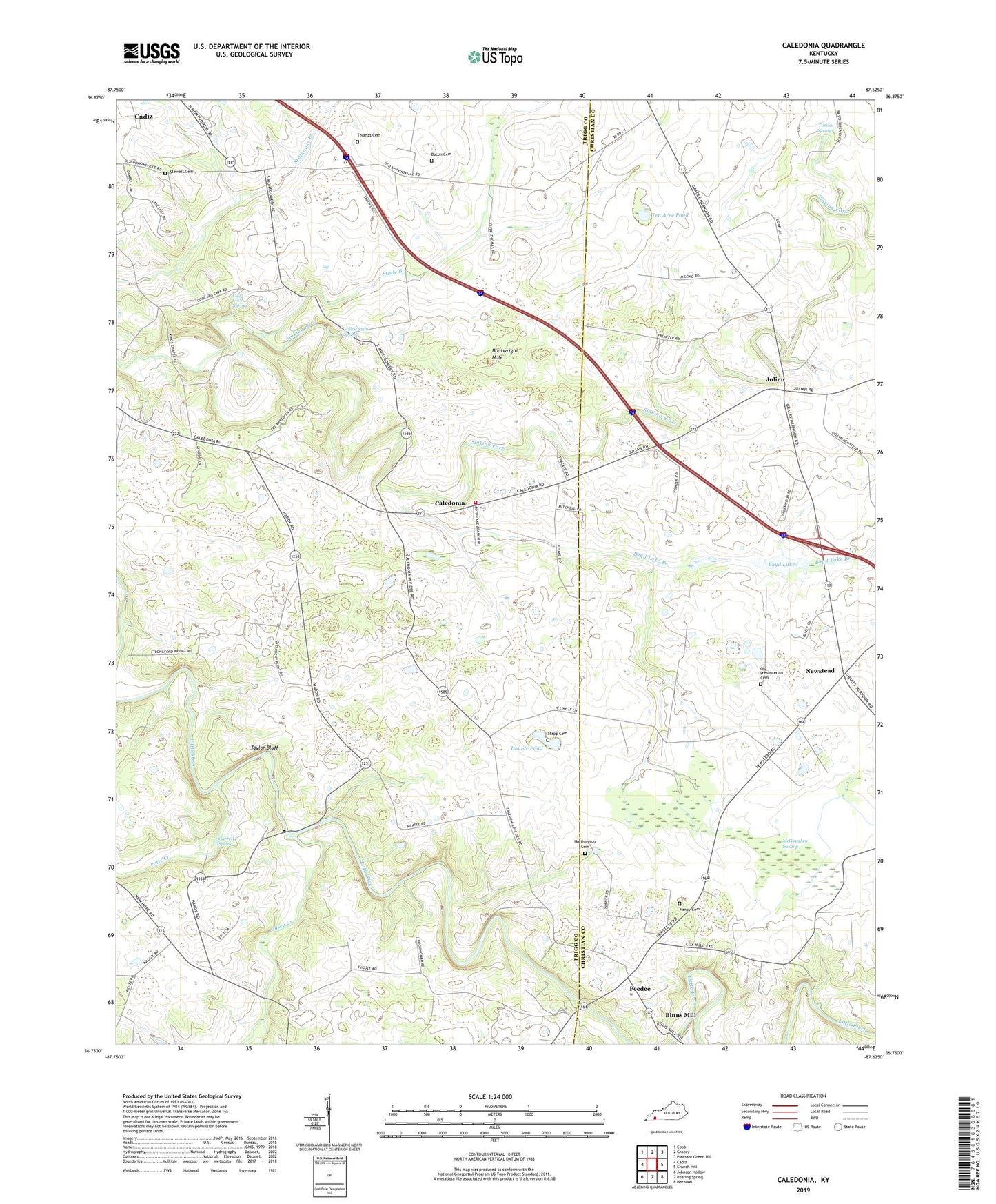
2022 topographic map quadrangle Caledonia in the state of Kentucky. Scale: 1:24000. Based on the newly updated USGS 7.5' US Topo map series, this map is in the following counties: Trigg, Christian. The map contains contour data, water features, and other items you are used to seeing on USGS maps, but also has updated roads and other features. This is the next generation of topographic maps. Printed on high-quality waterproof paper with UV fade-resistant inks.
Quads adjacent to this one:
West: Cadiz
Northwest: Cobb
North: Gracey
Northeast: Pleasant Green Hill
East: Church Hill
Southeast: Herndon
South: Roaring Spring
Southwest: Johnson Hollow
This map covers the same area as the classic USGS quad with code o36087g6.
Contains the following named places: Alfred Thomas Cemetery, Bacon Cemetery, Binns Mill, Boatwright Hole, Boyd Lake, Boyd Lake Branch, Caledonia, Caledonia Volunteer Fire Department, Casey Creek, Coon Cave Spring, Double Pond, Garrett Spring, Julien, Little River Church, Locust Grove Baptist Church, McGaughey Swamp, Mill Stream Spring, Nancy Cemetery, Newstead, Newstead Presbyterian Church, Northington Cemetery, Old Presbyterian Cemetery, Peedee, Potts Creek, Stapp Cemetery, Steele Branch, Stewart Cemetery, Taylor Bluff, Ten Acre Pond, Torian Springs, ZIP Code: 42232