MyTopo
Lancaster Kentucky US Topo Map
Couldn't load pickup availability
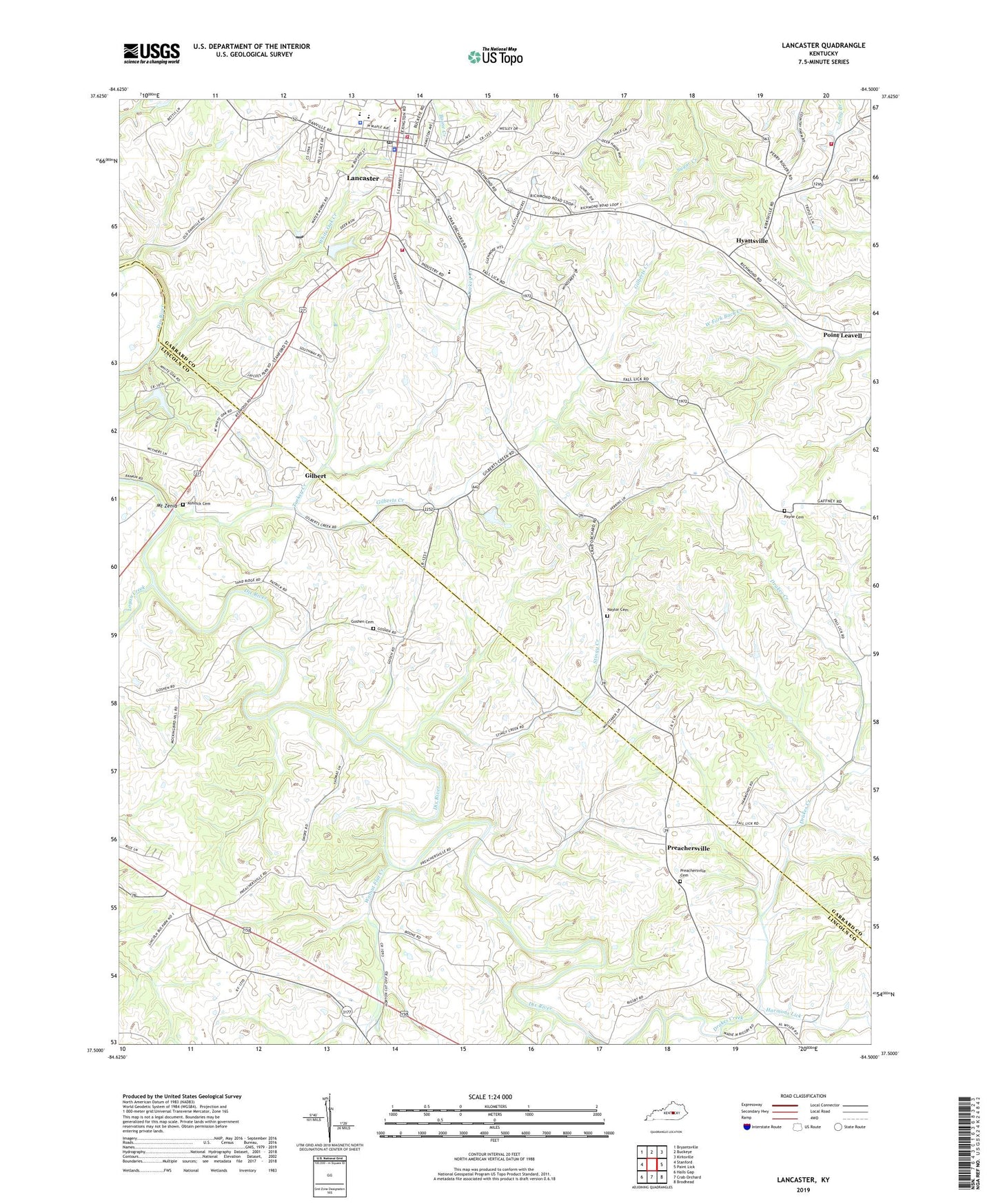
2022 topographic map quadrangle Lancaster in the state of Kentucky. Scale: 1:24000. Based on the newly updated USGS 7.5' US Topo map series, this map is in the following counties: Garrard, Lincoln. The map contains contour data, water features, and other items you are used to seeing on USGS maps, but also has updated roads and other features. This is the next generation of topographic maps. Printed on high-quality waterproof paper with UV fade-resistant inks.
Quads adjacent to this one:
West: Stanford
Northwest: Bryantsville
North: Buckeye
Northeast: Kirksville
East: Paint Lick
Southeast: Brodhead
South: Crab Orchard
Southwest: Halls Gap
This map covers the same area as the classic USGS quad with code o37084e5.
Contains the following named places: Ashlock Cemetery, Beasley School, Cedar Creek, City of Lancaster, District 1 Fire Department Station 2, Drakes Creek, Dudderars Mill, East Fork Drakes Creek, Fentons Plantation, Garrard County Ambulance Service, Garrard County Fire District One, Garrard County Sheriff's Office, Gilbert, Gilberts Creek, Gilberts Creek Church, Gilberts Creek Post Office, Gilberts Creek Railroad Station, Goshen, Goshen Cemetery, Goshen Church, Goshen School, Harmons Lick, Hyattsville, Hyattsville Post Office, Hyattsville Railroad Station, Lancaster, Lancaster Fire Department, Lancaster Police Department, Lancaster Post Office, Lawson School, Lawsons Chapel, Logan Creek, Mount Zenia, Naylor Cemetery, Payne Cemetery, Point Leavell Post Office, Point Leavell Railroad Station, Preachersville, Preachersville Cemetery, Preachersville Methodist Church, Preachersville Post Office, Preachersville School, Stingy Creek, Sweeney Post Office, Turkey Creek, Walnut Flat Creek, West Point School, White Oak Creek, WRNZ-FM (Lancaster)