MyTopo
Livermore Kentucky US Topo Map
Couldn't load pickup availability
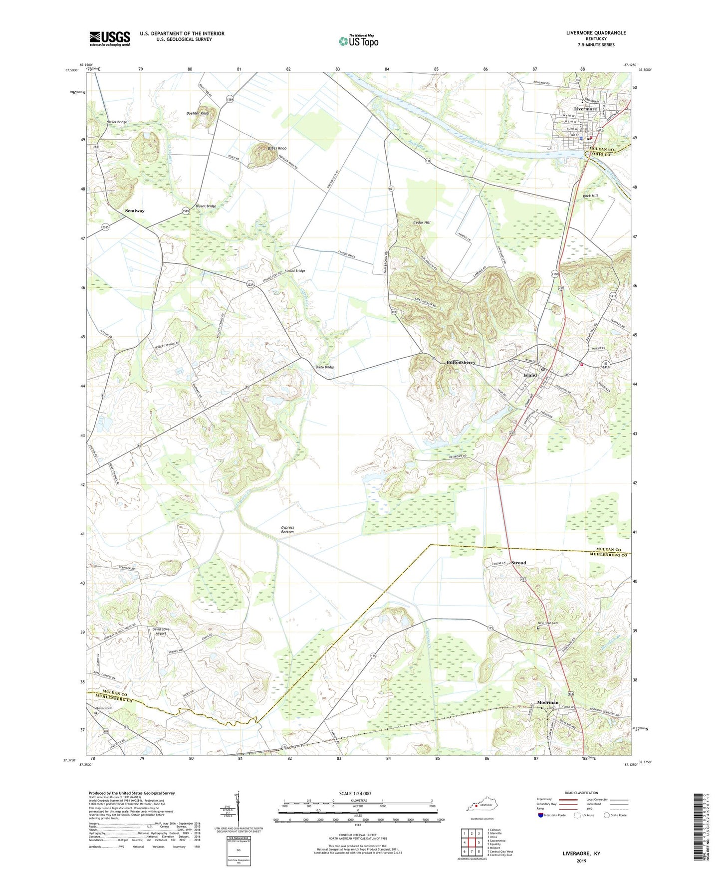
2022 topographic map quadrangle Livermore in the state of Kentucky. Scale: 1:24000. Based on the newly updated USGS 7.5' US Topo map series, this map is in the following counties: McLean, Muhlenberg, Ohio. The map contains contour data, water features, and other items you are used to seeing on USGS maps, but also has updated roads and other features. This is the next generation of topographic maps. Printed on high-quality waterproof paper with UV fade-resistant inks.
Quads adjacent to this one:
West: Sacramento
Northwest: Calhoun
North: Glenville
Northeast: Utica
East: Equality
Southeast: Central City East
South: Central City West
Southwest: Millport
This map covers the same area as the classic USGS quad with code o37087d2.
Contains the following named places: Basin Branch, Bates Knob, Boehler Knob, Bryant Bridge, Buttonsberry, Cedar Hill, Cemetery Hill, City of Island, City of Livermore, Cypress Bottom, David Lowe Airport, Island, Island Division, Island Post Office, Livermore, Livermore Bridge Historical Marker, Livermore Fire Department, Livermore Police Depatment, Livermore Post Office, Moorman, Moorman Census Designated Place, New Cypress Cumberland Presbyterian Church, New Hope Cemetery, Rock Hill, Rough River, Semiway, Shavers Cemetery, Sketo Bridge, Southeastern Fire Department, Station, Station Church, Stroud, Stroud Bridge, Underwood, Vicker Bridge, William Worthington Historical Marker, Worthington Chapel, Worthington Chapel United Methodist Church, ZIP Code: 42350