MyTopo
Calhoun Kentucky US Topo Map
Couldn't load pickup availability
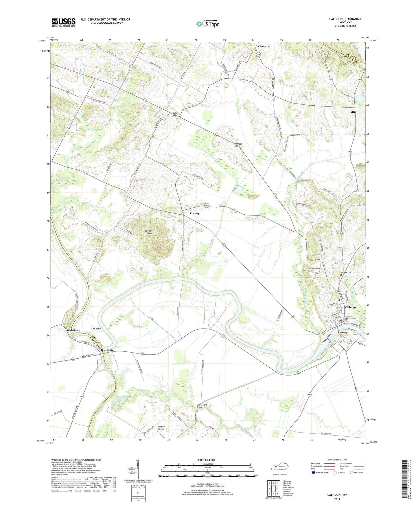
2022 topographic map quadrangle Calhoun in the state of Kentucky. Scale: 1:24000. Based on the newly updated USGS 7.5' US Topo map series, this map is in the following counties: McLean, Hopkins, Daviess. The map contains contour data, water features, and other items you are used to seeing on USGS maps, but also has updated roads and other features. This is the next generation of topographic maps. Printed on high-quality waterproof paper with UV fade-resistant inks.
Quads adjacent to this one:
West: Beech Grove
Northwest: Delaware
North: Curdsville
Northeast: Panther
East: Glenville
Southeast: Livermore
South: Sacramento
Southwest: Hanson
This map covers the same area as the classic USGS quad with code o37087e3.
Contains the following named places: Antioch Church, Ashbyburg, Calhoun, Calhoun Cemetery, Calhoun City Fire Department, Calhoun Division, Calhoun Post Office, Cave Creek, Charles Hansford Historical Marker, City of Calhoun, Cleopatra, Corporal James Bethel Gresham Memorial Bridge Historical Marker, Cypress Creek, Eagle Creek, General Forrest Reconnaissance Historical Marker, Glovers, Gravel Ford Bridge, Guffie, Jewel City, Johnson Island, Leachman, Lock Number 2, Long Falls Creek, Mayo Hills, McLean County, McLean County Ambulance Service, McLean County Central District Fire Department, McLean County Historical Marker, McLean County Sheriff's Office, Moseley Field, Mount Vernon, Mount Vernon Baptist Church, Myer Creek, Otter Creek, Pitman Creek, Pond River, Poverty, Rumsey, Rumsey Census Designated Place, Rumsey Historical Marker, Saint Sebastian School, Shutts, Shutts Chapel, Smith Airport, The Bend, Tichenor Hills, Woosley Airport, Woosley Field, ZIP Codes: 42327, 42371