MyTopo
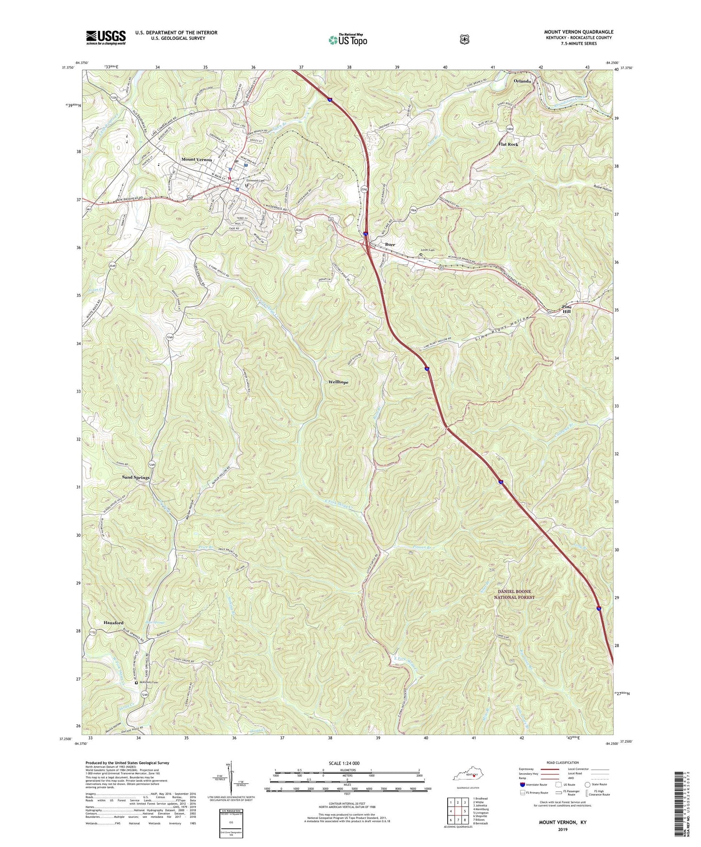
Mount Vernon Kentucky US Topo Map
Couldn't load pickup availability
Also explore the Mount Vernon Forest Service Topo of this same quad for updated USFS data
2022 topographic map quadrangle Mount Vernon in the state of Kentucky. Scale: 1:24000. Based on the newly updated USGS 7.5' US Topo map series, this map is in the following counties: Rockcastle. The map contains contour data, water features, and other items you are used to seeing on USGS maps, but also has updated roads and other features. This is the next generation of topographic maps. Printed on high-quality waterproof paper with UV fade-resistant inks.
Quads adjacent to this one:
West: Maretburg
Northwest: Brodhead
North: Wildie
Northeast: Johnetta
East: Livingston
Southeast: Bernstadt
South: Billows
Southwest: Shopville
This map covers the same area as the classic USGS quad with code o37087h8.
Contains the following named places: Bible Church, Blue Springs, Blue Springs School, Brush Creek Railroad Station, Burr, Chestnut Ridge Church, City of Mount Vernon, Cook Railroad Stop, Cove Branch, Dry Fork, Elmwood Cemetery, Flat Rock, Hansford, Lime Plant Hollow, Lover Cemetery, Maple Grove Church, Maple Grove School, Marlow Hollow, McKinney Cemetery, Mount Vernon, Mount Vernon Police Department, Mount Vernon Post Office, Mount Vernon Volunteer Fire Department, Orlando, Owens Station, Penick Hollow, Pine Hill, Pine Hill Railroad Station, Pitman Branch, Price Branch, Rash Branch, Rockcastle County, Rockcastle County Ambulance Service, Rockcastle County Sheriff's Office, Rockcastle Regional Hospital, Sand Springs, Sites Branch, Sparks Quarry Station, Sparks Vocational School, The Central Church, Wellhope, Wellhope Church, Wellhope School, West Fork Skegg Creek, ZIP Code: 40456