MyTopo
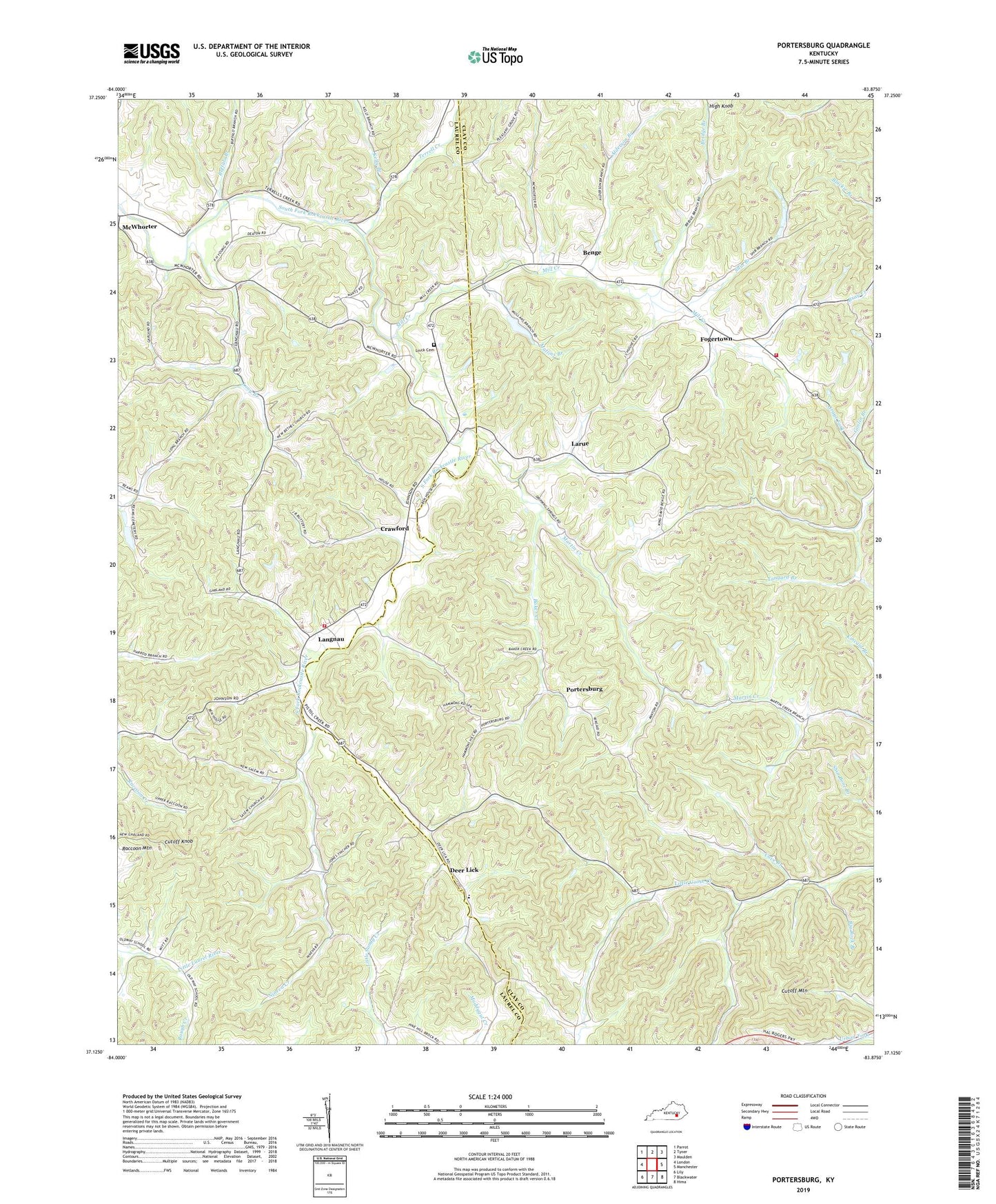
Portersburg Kentucky US Topo Map
Couldn't load pickup availability
Also explore the Portersburg Forest Service Topo of this same quad for updated USFS data
2022 topographic map quadrangle Portersburg in the state of Kentucky. Scale: 1:24000. Based on the newly updated USGS 7.5' US Topo map series, this map is in the following counties: Clay, Laurel. The map contains contour data, water features, and other items you are used to seeing on USGS maps, but also has updated roads and other features. This is the next generation of topographic maps. Printed on high-quality waterproof paper with UV fade-resistant inks.
Quads adjacent to this one:
West: London
Northwest: Parrot
North: Tyner
Northeast: Maulden
East: Manchester
Southeast: Hima
South: Blackwater
Southwest: Lily
This map covers the same area as the classic USGS quad with code o37083b8.
Contains the following named places: Alderson Branch, Alliance Church, Baker Creek, Benge, Benge Post Office, Big Rock Branch, Bridge Branch, Buffalo Branch, Byron Post Office, Byron School, Cave Branch, Crawford, Cutoff Knob, Cutoff Mountain, Darl Jones School, Deer Lick, Deer Lick Post Office, Dripping Springs School, Elvira Post Office, Fogerton Post Office, Fogertown, Fogertown Fire and Rescue Department, Fogertown School, Goslin Branch, Hammons Hill School, High Knob, House's Store Post Office, Kelly Branch, Langnau, Langnau School, Larue, Lebanon, Lebanon Church, Lebanon School, Linck Cemetery, Long Branch, Long Branch Church, Long Branch School, Martin Creek, McWhorter, McWhorter Volunteer Fire Department Station 2, Mill Creek, Mullins Branch, New Bethel Church, New Salem Church, New Salem School, Nineva Creek, Old Way School, Pleasant Grove Church, Pleasant Hill, Portersburg, Portersburg Post Office, Raccoon Mountain, Seeley Post Office, Shib Branch, Terrell Creek, Terrell Creek School, Wyatts Chapel, Wyatts Chapel School, Zacata Post Office