MyTopo
Union Kentucky US Topo Map
Couldn't load pickup availability
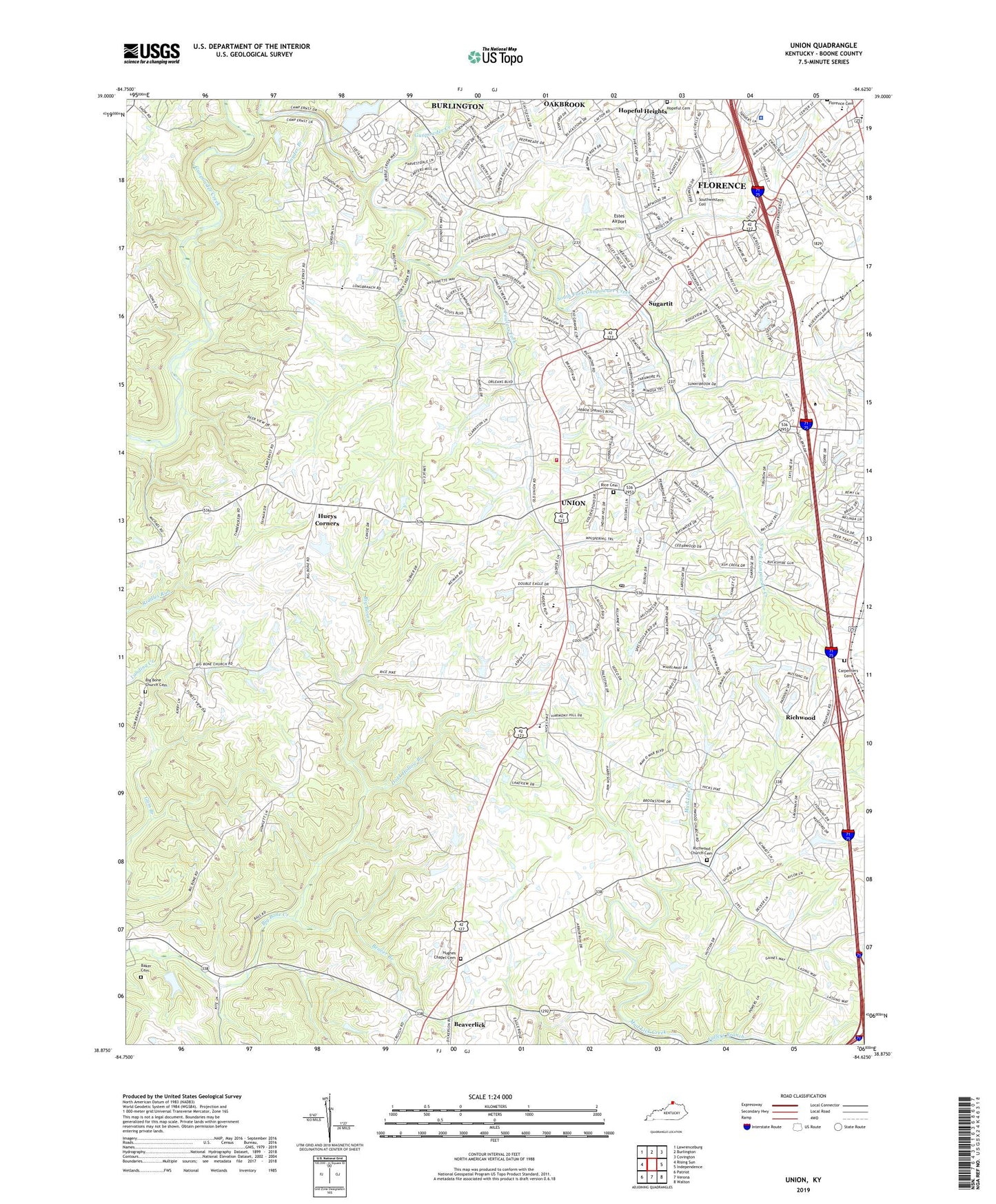
2022 topographic map quadrangle Union in the state of Kentucky. Scale: 1:24000. Based on the newly updated USGS 7.5' US Topo map series, this map is in the following counties: Boone. The map contains contour data, water features, and other items you are used to seeing on USGS maps, but also has updated roads and other features. This is the next generation of topographic maps. Printed on high-quality waterproof paper with UV fade-resistant inks.
Quads adjacent to this one:
West: Rising Sun
Northwest: Lawrenceburg
North: Burlington
Northeast: Covington
East: Independence
Southeast: Walton
South: Verona
Southwest: Patriot
This map covers the same area as the classic USGS quad with code o38084h6.
Contains the following named places: A M Yealey Elementary School, Baker Cemetery, Beaver Branch, Beaverlick, Beaverlick Post Office, Bethel Baptist Church, Big Bone Baptist Church, Big Bone Church Cemetery, Boone County, Boone County Public Library, Camp Ernst, Camp Michael, Carpenters Cemetery, City of Florence, City of Union, Dark Hollow Branch, Estes Airport, Excelsior Grange Hall, Florence, Florence Baptist Church, Florence Center Shopping Center, Florence Christian Church, Florence Division, Florence Fire / EMS Department Station 1, Florence Mall Shopping Center, Florence Plaza Shopping Center, Florence Police Department, Florence Square Shopping Center, Fowlers Fork, Fullers Branch, Grace Church, Grange Hall, Gunpowder Church, Gunpowder Post Office, Hathaway Post Office, Heritage Academy, Heritage Assembly of God Church, Hopeful Lutheran Church, Hueys Corners, Hughes Chapel, Hughes Chapel Cemetery, Kentucky Raceway, LifePointe Family Church, Lincoln Woods Park, Long Branch, Mall Road Center Shopping Center, Mall Road Square Shopping Center, Mud Lick Church, New Haven Elementary School, Oakbrook, Oakbrook Census Designated Place, Ockerman Elementary School, Ockerman Middle School, Rice Cemetery, Richwood Church Cemetery, Richwood Post Office, Richwood Presbyterian Church, Saint Paul Church, Saint Paul Elementary School, Snyder Branch, South Fork Gunpowder Creek, South Fork Park, Sugartit, Triple Crown Country Club, Union, Union Baptist Church, Union Emergency Services Alliance, Union Emergency Services Alliance Station 1, Union Post Office, Union Presbyterian Church, Village At The Mall Shopping Center, White Haven, WMLX-AM (Florence), ZIP Code: 41091