MyTopo
Como Louisiana US Topo Map
Couldn't load pickup availability
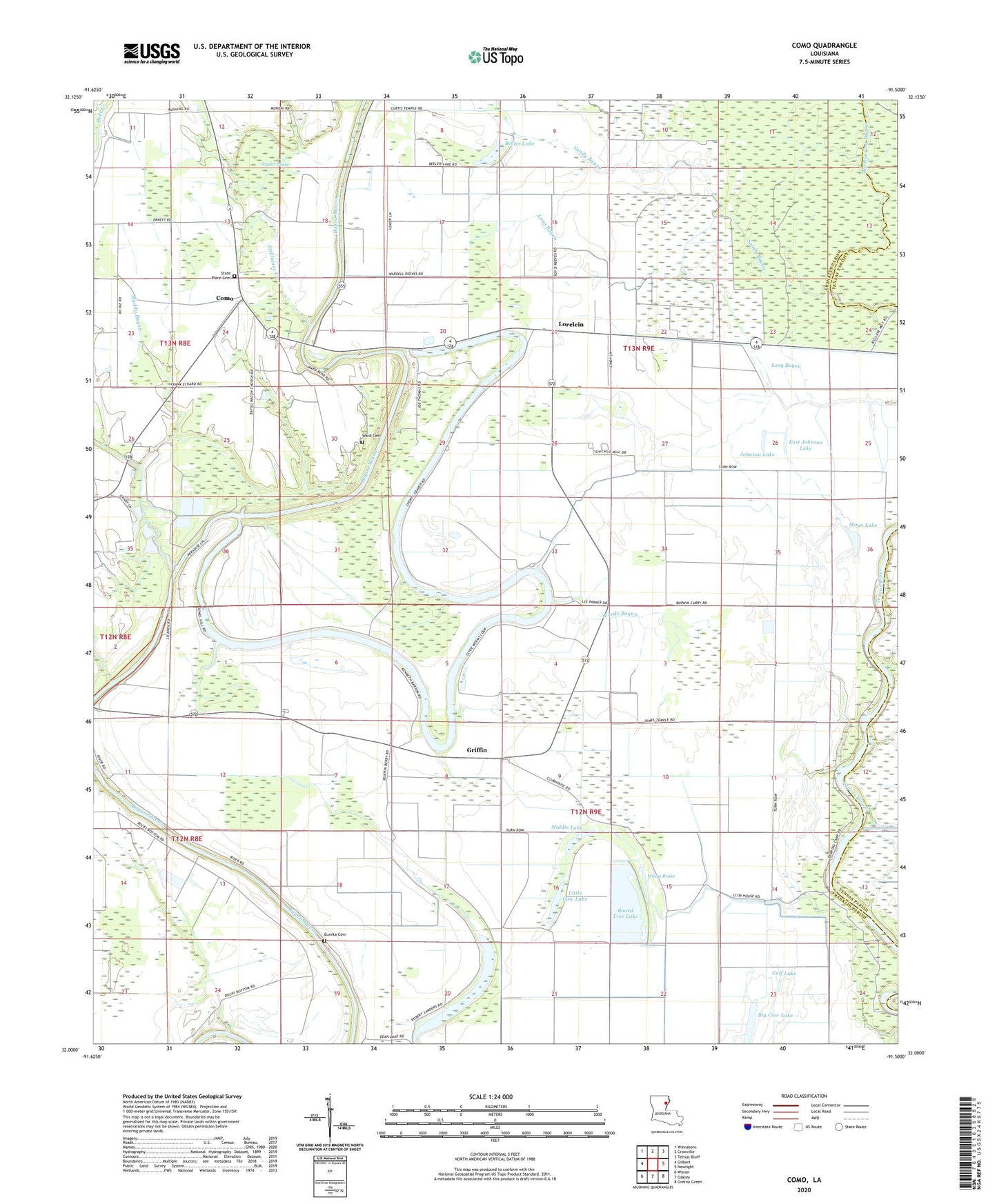
2024 topographic map quadrangle Como in the state of Louisiana. Scale: 1:24000. Based on the newly updated USGS 7.5' US Topo map series, this map is in the following counties: Franklin, Tensas. The map contains contour data, water features, and other items you are used to seeing on USGS maps, but also has updated roads and other features. This is the next generation of topographic maps. Printed on high-quality waterproof paper with UV fade-resistant inks.
Quads adjacent to this one:
West: Gilbert
Northwest: Winnsboro
North: Crowville
Northeast: Tensas Bluff
East: Newlight
Southeast: Gretna Green
South: Oakley
Southwest: Wisner
This map covers the same area as the classic USGS quad with code o32091a5.
Contains the following named places: Bayou Macon Baptist Church, Bayou Macon Cutoff Number One, Beeler Lake, Bethel Christian Center, Bethel School, Big Cow Lake, Board Tree Lake, Calf Lake, Church of God, Como, Cordill School, Cuba Baptist Church, Cuba School, Dickey Landing, Dixie Landing, East Johnson Lake, Eureka Baptist Church, Eureka Cemetery, Griffin, Harris Landing, Johnson Lake, Lake Dean, Little Cow Lake, Long Bayou, Lorelein, Middle Lake, Moon Lake, Muddy Bayou, Oakley Landing, Oakwood Landing, Parish Governing Authority District 3, Sandy Bayou, Snyder Brake, State Place Cemetery, Stillhouse Creek, Stones Landing, Talbot Landing, Ward Cemetery, Wards Bayou, Wileys Brake, ZIP Code: 71336