MyTopo
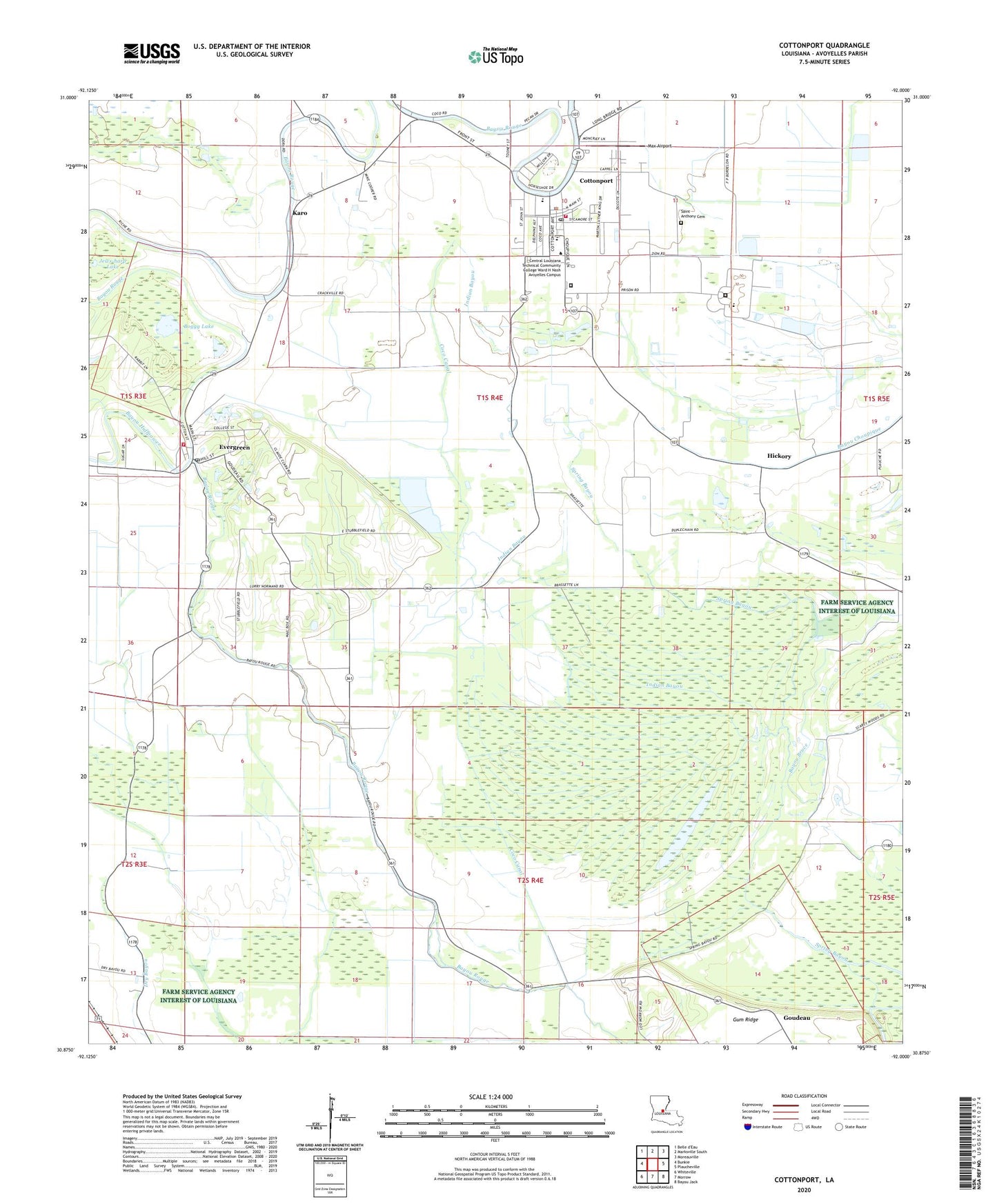
Cottonport Louisiana US Topo Map
Couldn't load pickup availability
2024 topographic map quadrangle Cottonport in the state of Louisiana. Scale: 1:24000. Based on the newly updated USGS 7.5' US Topo map series, this map is in the following counties: Avoyelles. The map contains contour data, water features, and other items you are used to seeing on USGS maps, but also has updated roads and other features. This is the next generation of topographic maps. Printed on high-quality waterproof paper with UV fade-resistant inks.
Quads adjacent to this one:
West: Bunkie
North: Marksville South
Northeast: Moreauville
East: Plaucheville
Southeast: Bayou Jack
South: Morrow
Southwest: Whiteville
This map covers the same area as the classic USGS quad with code o30092h1.
Contains the following named places: Avoyelles Parish Women's Correctional Center, Bayou Bruce, Bayou Huffpower, Big Buttonwood Lake, Big Cane Gas Field, Boggy Lake, Central Louisiana Technical Community College Ward H Nash Avoyelles Campus, Coco Canal, Cottonport, Cottonport Elementary School, Cottonport High School, Cottonport Police Department, Cottonport Post Office, Cottonport Volunteer Fire and Rescue, Deats, Dora, Dry Bayou Church, Enterprise, Evergreen, Evergreen High School, Evergreen Post Office, Evergreen Volunteer Fire Department, First Evening Star Baptist Church, Golden Chain Church, Hickory, Indian Bayou, Jerusalem Church, Jews-harp Lake, Karo, KRBG-FM (Bunkie), Magnolia Church, Max Airport, Morning Star Church, New Light Church, Old Zion Church, Parish Governing Authority District 11, Raymond Laborde Correctional Center, Raymond Laborde Correctional Center School, Saint Anthony Cemetery, Saint Anthony School, Saint Johns Church, Saint Mary's Assumption School, Saint Marys Catholic Church, Town of Cottonport, Town of Evergreen, Ward Nine, ZIP Codes: 71327, 71333