MyTopo
Plaucheville Louisiana US Topo Map
Couldn't load pickup availability
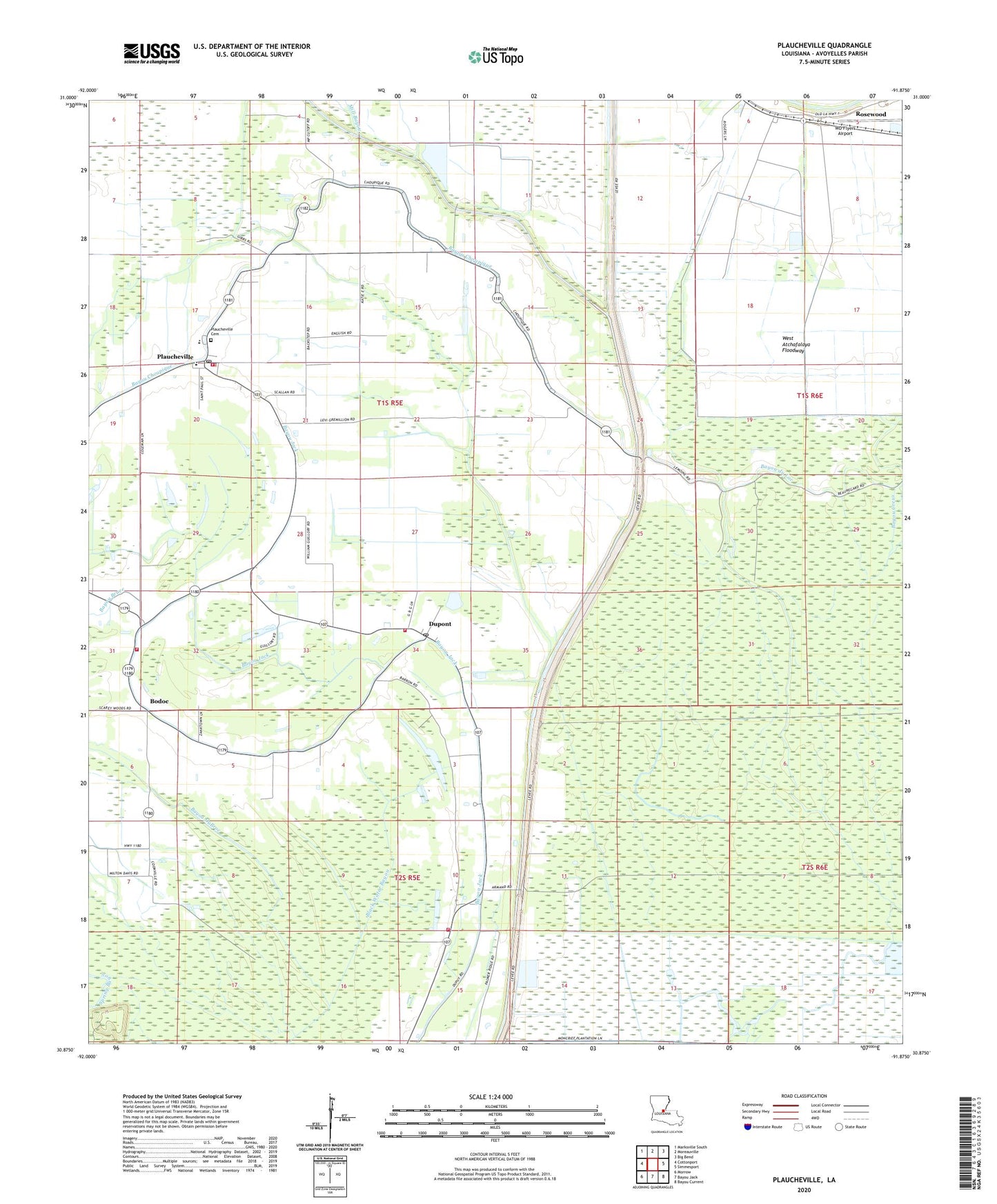
2024 topographic map quadrangle Plaucheville in the state of Louisiana. Scale: 1:24000. Based on the newly updated USGS 7.5' US Topo map series, this map is in the following counties: Avoyelles. The map contains contour data, water features, and other items you are used to seeing on USGS maps, but also has updated roads and other features. This is the next generation of topographic maps. Printed on high-quality waterproof paper with UV fade-resistant inks.
Quads adjacent to this one:
West: Cottonport
Northwest: Marksville South
North: Moreauville
Northeast: Big Bend
East: Simmesport
Southeast: Bayou Current
South: Bayou Jack
Southwest: Morrow
This map covers the same area as the classic USGS quad with code o30091h8.
Contains the following named places: Bayou Choupique, Bayou du Lac, Bayou DuBroc, Bayou Jacque Church, Bodoc, Bodoc Church, Bodoc Post Office, Broussard, Choupique Canal, Dupont, Dupont Volunteer Fire Department Main Station, DuPont Volunteer Fire Department Sub Station 1, DuPont Volunteer Fire Department Sub Station 2, Immaculate Conception Catholic Church, Lac Choupique, Mater Doloresa Catholic Church, North Bayou Jack Oil and Gas Field, Plaucheville, Plaucheville Cemetery, Plaucheville Elementary School, Plaucheville High School, Plaucheville Post Office, Plaucheville Volunteer Fire Department, Rosewood, Saint Joseph Junior High School, Saint Joseph School, Village of Plaucheville, Ward Eight, WD Flyers Airport, West Protection Levee, ZIP Codes: 71362, 71369