MyTopo
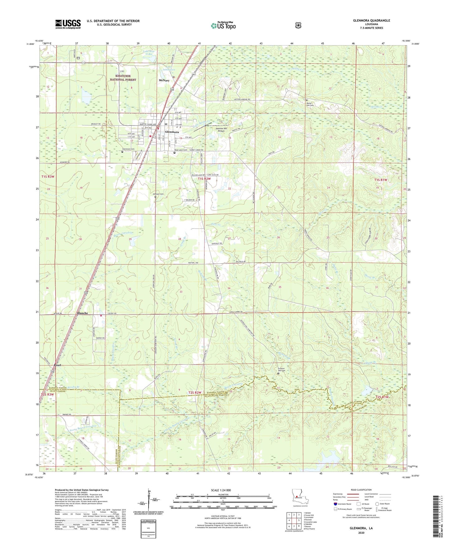
Glenmora Louisiana US Topo Map
Couldn't load pickup availability
Also explore the Glenmora Forest Service Topo of this same quad for updated USFS data
2024 topographic map quadrangle Glenmora in the state of Louisiana. Scale: 1:24000. Based on the newly updated USGS 7.5' US Topo map series, this map is in the following counties: Rapides, Evangeline, Allen. The map contains contour data, water features, and other items you are used to seeing on USGS maps, but also has updated roads and other features. This is the next generation of topographic maps. Printed on high-quality waterproof paper with UV fade-resistant inks.
Quads adjacent to this one:
West: Pawnee
Northwest: Melder
North: Forest Hill
Northeast: Lecompte
East: Cocodrie Lake
Southeast: Pine Prairie
South: Beaver
Southwest: Oakdale
This map covers the same area as the classic USGS quad with code o30092h5.
Contains the following named places: Andrus Landing Field, Blanche, Brushy Branch, Camp Paradise, Diana Branch, First United Pentecostal Church, Glenmora, Glenmora Baptist Church, Glenmora Cemetery, Glenmora Church of Christ, Glenmora Elementary School, Glenmora High School, Glenmora Oil and Gas Field, Glenmora United Methodist Church, Glenmora Volunteer Fire Department Station 1, Glenmora Volunteer Fire Department Station 2, Grace Christian Center, Harmony Baptist Church, Independent Baptist Church, James Landing Strip, Jasmine Hill Airport, Johnson Cemetery, Lake Hop-O-Bee, Lake Jubenicwa, Longs Branch, Louisiana Noname 98 Dam, McKemb Branch, McNary, McNary Police Department, Miller Landing Strip, Mount Pilgrim Baptist Church, Pearl, Rocky Hill Cemetery, Rose Lawn Cemetery, Saint Louis Catholic Church, Science Hill Cemetery, Science Hill Church, South Prong Bayou Cocodrie, Spring Creek Volunteer Fire Department Station 4, Spring Hill Ward Four, Town of Glenmora, Village of McNary