MyTopo
Hortman Louisiana US Topo Map
Couldn't load pickup availability
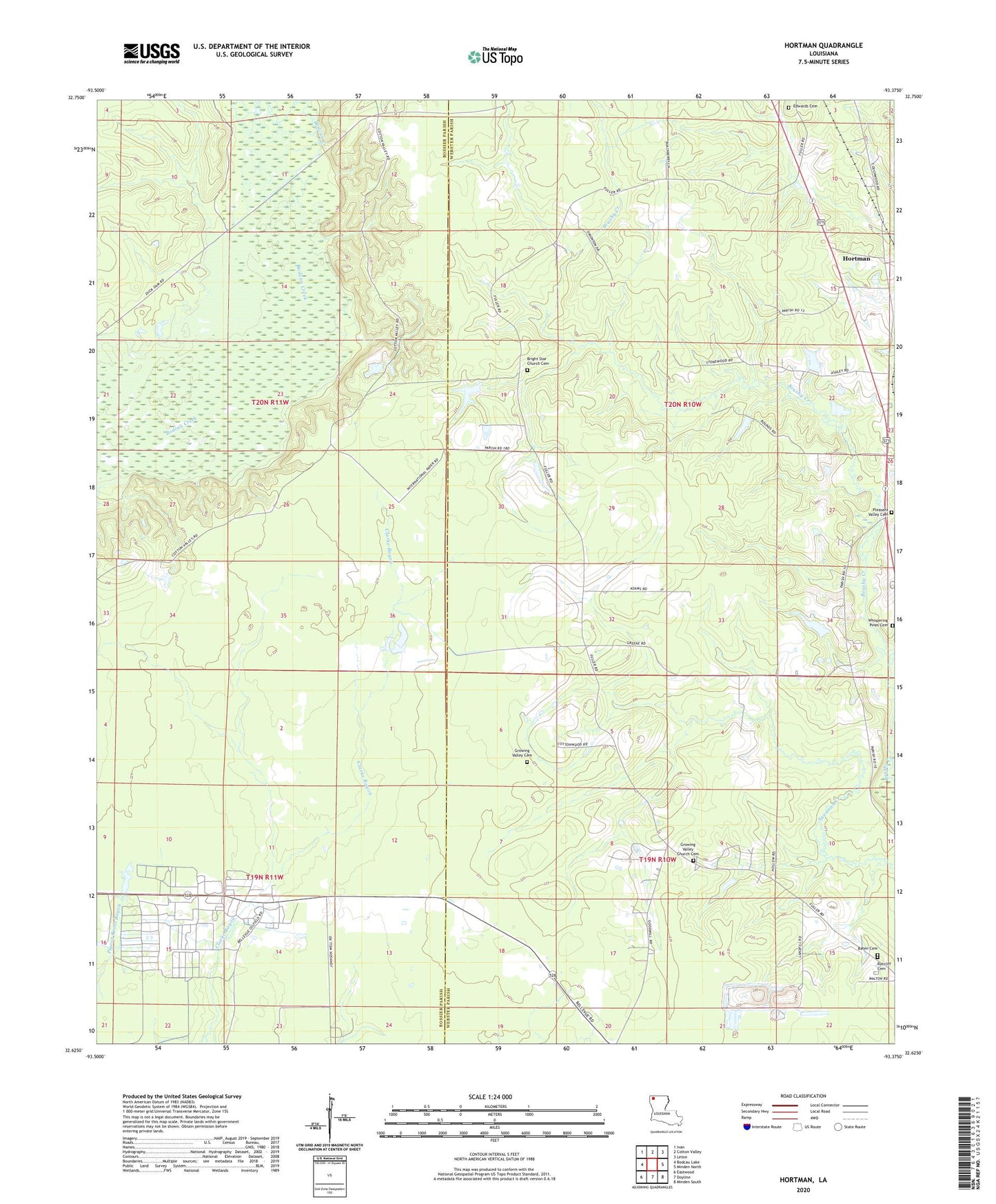
2024 topographic map quadrangle Hortman in the state of Louisiana. Scale: 1:24000. Based on the newly updated USGS 7.5' US Topo map series, this map is in the following counties: Webster, Bossier. The map contains contour data, water features, and other items you are used to seeing on USGS maps, but also has updated roads and other features. This is the next generation of topographic maps. Printed on high-quality waterproof paper with UV fade-resistant inks.
Quads adjacent to this one:
West: Bodcau Lake
Northwest: Ivan
North: Cotton Valley
Northeast: Leton
East: Minden North
Southeast: Minden South
South: Doyline
Southwest: Eastwood
This map covers the same area as the classic USGS quad with code o32093f4.
Contains the following named places: Ambrose School, Baten Cemetery, Bayou Bodcau Reservoir, Bellevue Oil and Gas Field, Bright Star School, Brushy Creek School, Edwards Cemetery, Growing Valley Cemetery, Growing Valley Church, Growing Valley School, H G Hayes Pond Dam, Hires Chapel, Hortman, Hortmans Store, Parish Governing Authority District 5, Pleasant Hill Church, Pleasant Valley Cemetery, Pleasant Valley United Methodist Church, Ratcliff Cemetery, Whispering Pines Cemetery