MyTopo
Jonesboro South Louisiana US Topo Map
Couldn't load pickup availability
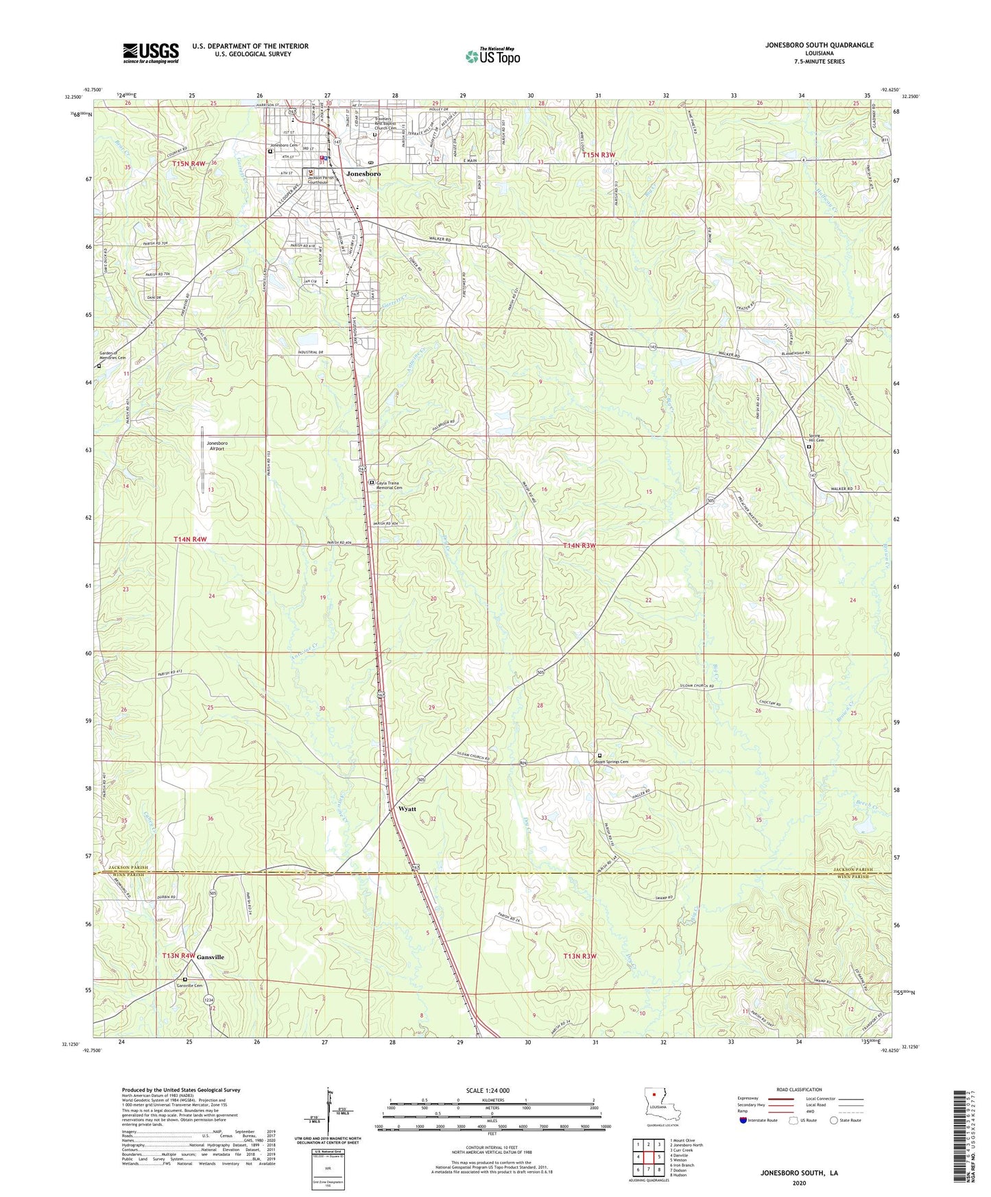
2024 topographic map quadrangle Jonesboro South in the state of Louisiana. Scale: 1:24000. Based on the newly updated USGS 7.5' US Topo map series, this map is in the following counties: Jackson, Winn. The map contains contour data, water features, and other items you are used to seeing on USGS maps, but also has updated roads and other features. This is the next generation of topographic maps. Printed on high-quality waterproof paper with UV fade-resistant inks.
Quads adjacent to this one:
West: Danville
Northwest: Mount Olive
North: Jonesboro North
Northeast: Curr Creek
East: Weston
Southeast: Hudson
South: Dodson
Southwest: Iron Branch
This map covers the same area as the classic USGS quad with code o32092b6.
Contains the following named places: Argola Church, Beech Creek, Brown Creek, Dry Creek, Gansville, Gansville Cemetery, Gayla Traina Memorial Cemetery, Jackson Parish Adult Education Center, Jackson Parish Sheriff's Office, Jonesboro, Jonesboro - Hodge Elementary School, Jonesboro - Hodge High School, Jonesboro Airport, Jonesboro Cemetery, Jonesboro Fire Department, Jonesboro Gas Field, Jonesboro Hodge Middle School, Jonesboro Lookout Tower, Jonesboro Police Department, Jonesboro Post Office, KTOC-AM (Jonesboro), KTOC-FM (Jonesboro), Parish Governing Authority District 5, Parish Governing Authority District 6, Shady Grove Church, Siloam Springs, Siloam Springs Cemetery, Siloam Springs Methodist Church, Spring Hill, Spring Hill Cemetery, Spring Hill Primitive Baptist Church, Town of Jonesboro, Ward Five, Ward Seven, Ward Six, Wyatt, ZIP Code: 71251