MyTopo
Weston Louisiana US Topo Map
Couldn't load pickup availability
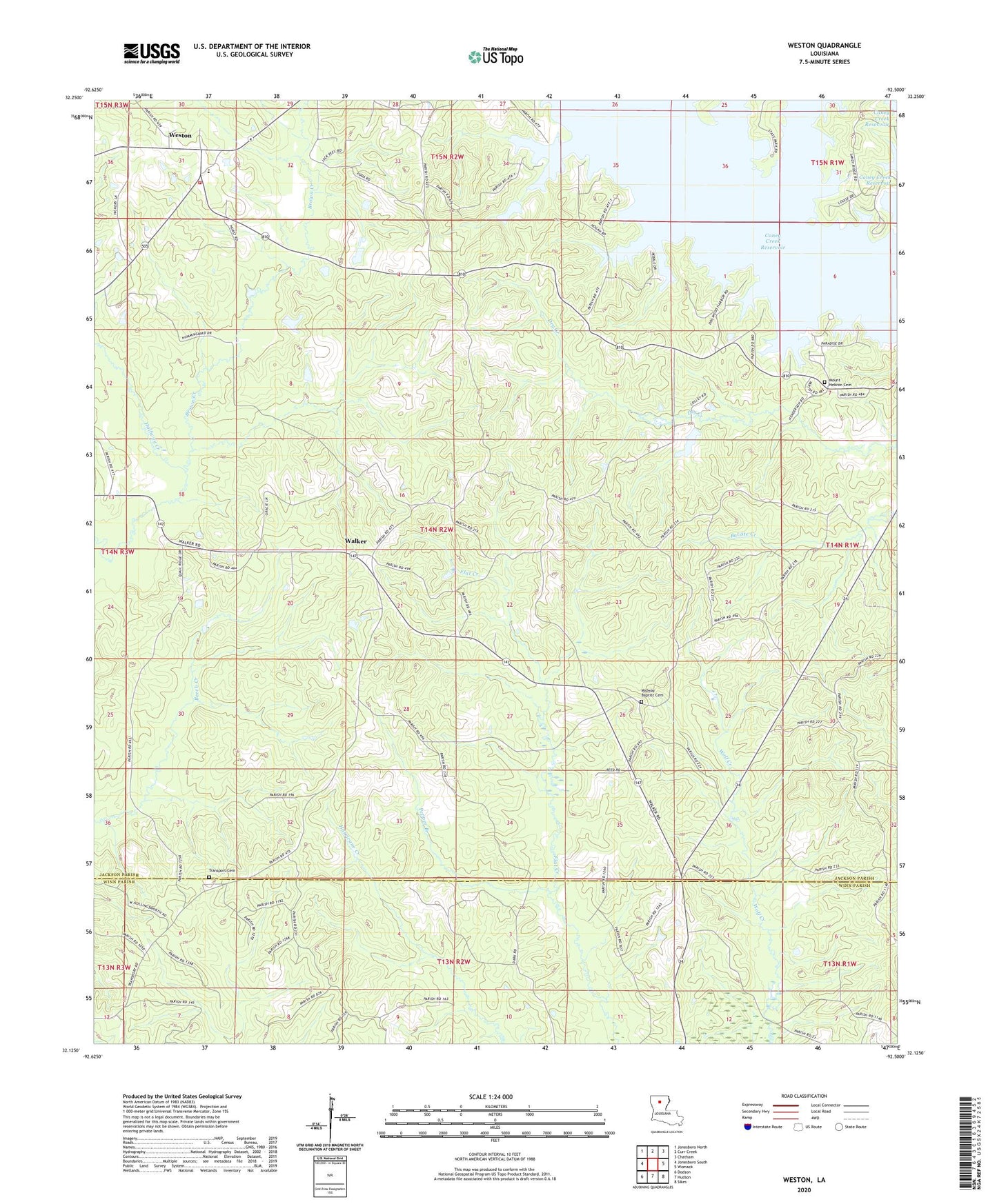
2024 topographic map quadrangle Weston in the state of Louisiana. Scale: 1:24000. Based on the newly updated USGS 7.5' US Topo map series, this map is in the following counties: Jackson, Winn. The map contains contour data, water features, and other items you are used to seeing on USGS maps, but also has updated roads and other features. This is the next generation of topographic maps. Printed on high-quality waterproof paper with UV fade-resistant inks.
Quads adjacent to this one:
West: Jonesboro South
Northwest: Jonesboro North
North: Curr Creek
Northeast: Chatham
East: Womack
Southeast: Sikes
South: Hudson
Southwest: Dodson
This map covers the same area as the classic USGS quad with code o32092b5.
Contains the following named places: Boatner, Caney Creek, Caney Creek Reservoir, Clear Branch, Halfway Creek, Hancock Creek, Jimmie Davis State Park, Midway Baptist Church, Mount Hebron, Mount Hebron Cemetery, Mount Hebron School, Pepper Branch, Transport Cemetery, Transport Church, Walker, Walker High School, Ward Four, Ward Four Fire Protection District, Weston, Weston High School, Weston Playground