MyTopo
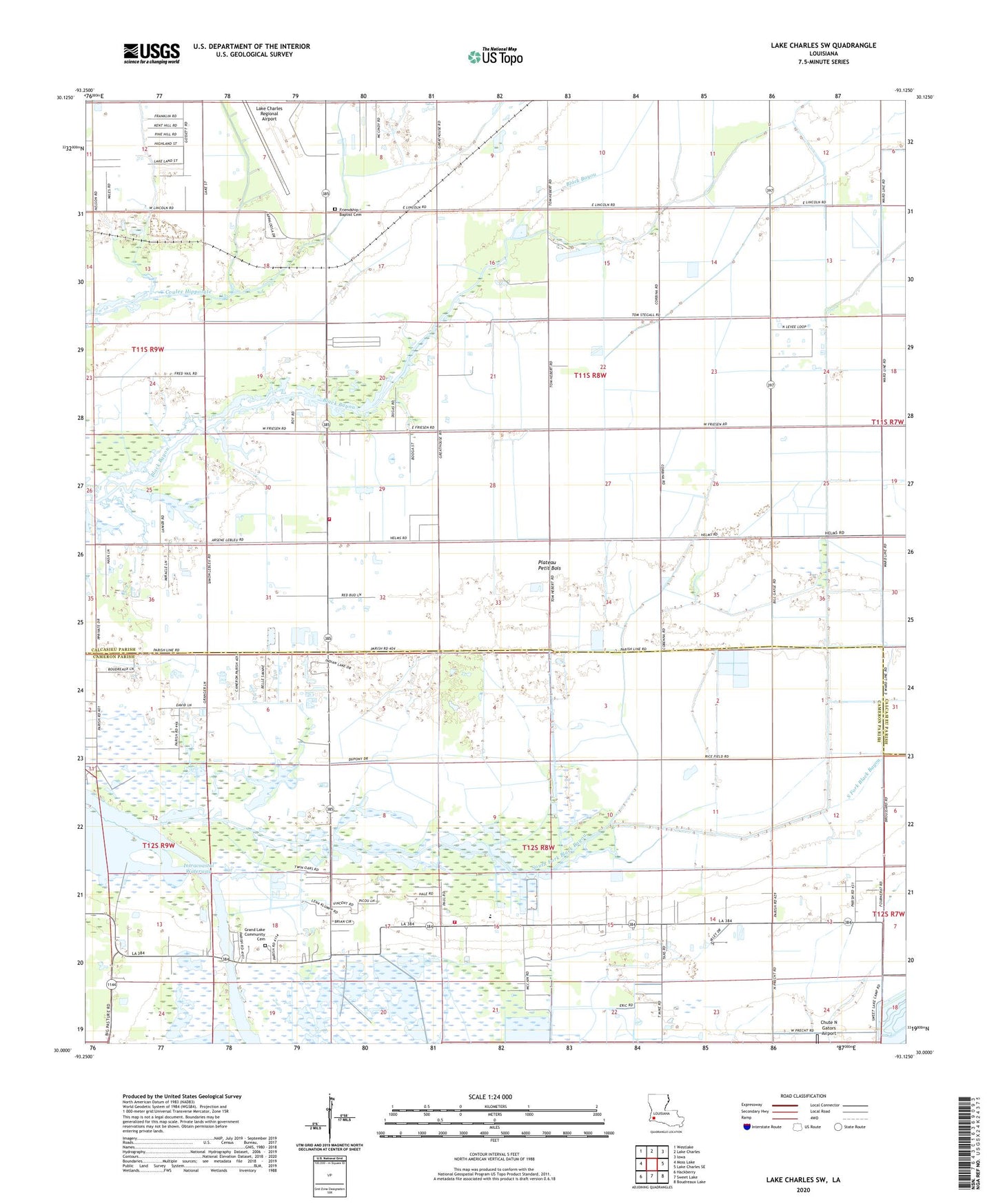
Lake Charles SW Louisiana US Topo Map
Couldn't load pickup availability
2024 topographic map quadrangle Lake Charles SW in the state of Louisiana. Scale: 1:24000. Based on the newly updated USGS 7.5' US Topo map series, this map is in the following counties: Calcasieu, Cameron. The map contains contour data, water features, and other items you are used to seeing on USGS maps, but also has updated roads and other features. This is the next generation of topographic maps. Printed on high-quality waterproof paper with UV fade-resistant inks.
Quads adjacent to this one:
West: Moss Lake
Northwest: Westlake
North: Lake Charles
Northeast: Iowa
East: Lake Charles SE
Southeast: Boudreaux Lake
South: Sweet Lake
Southwest: Hackberry
This map covers the same area as the classic USGS quad with code o30093a2.
Contains the following named places: Big Lake Oil Field, Cameron Parish Library Grand Lake Branch, Cameron Parish Sheriff's Department, Fire Protection District 2 Ward 3, Grand Lake Community Cemetery, Grand Lake Faith Temple, Grand Lake High School, Grand Lake School, Grand Lake Sweet Lake Volunteer Fire Department, Grand Lake Ward Four, Gulf Stream Manor Mobile Home Park, Herbert Trailer Park, Lake Charles Office Heliport, Lake Charles Regional Airport, Parish Governing Authority District 7, Prairieland, Prairieland Community Church, Prairieland School, Saint Elizabeth Church, Saint Marys Church, South Fork Black Bayou, South Lake Charles Gas Field, South Lake Charles Oil Field, Sweet Lake Ferry, Vineyard Christian Fellowship Church, ZIP Code: 70607