MyTopo
Sweet Lake Louisiana US Topo Map
Couldn't load pickup availability
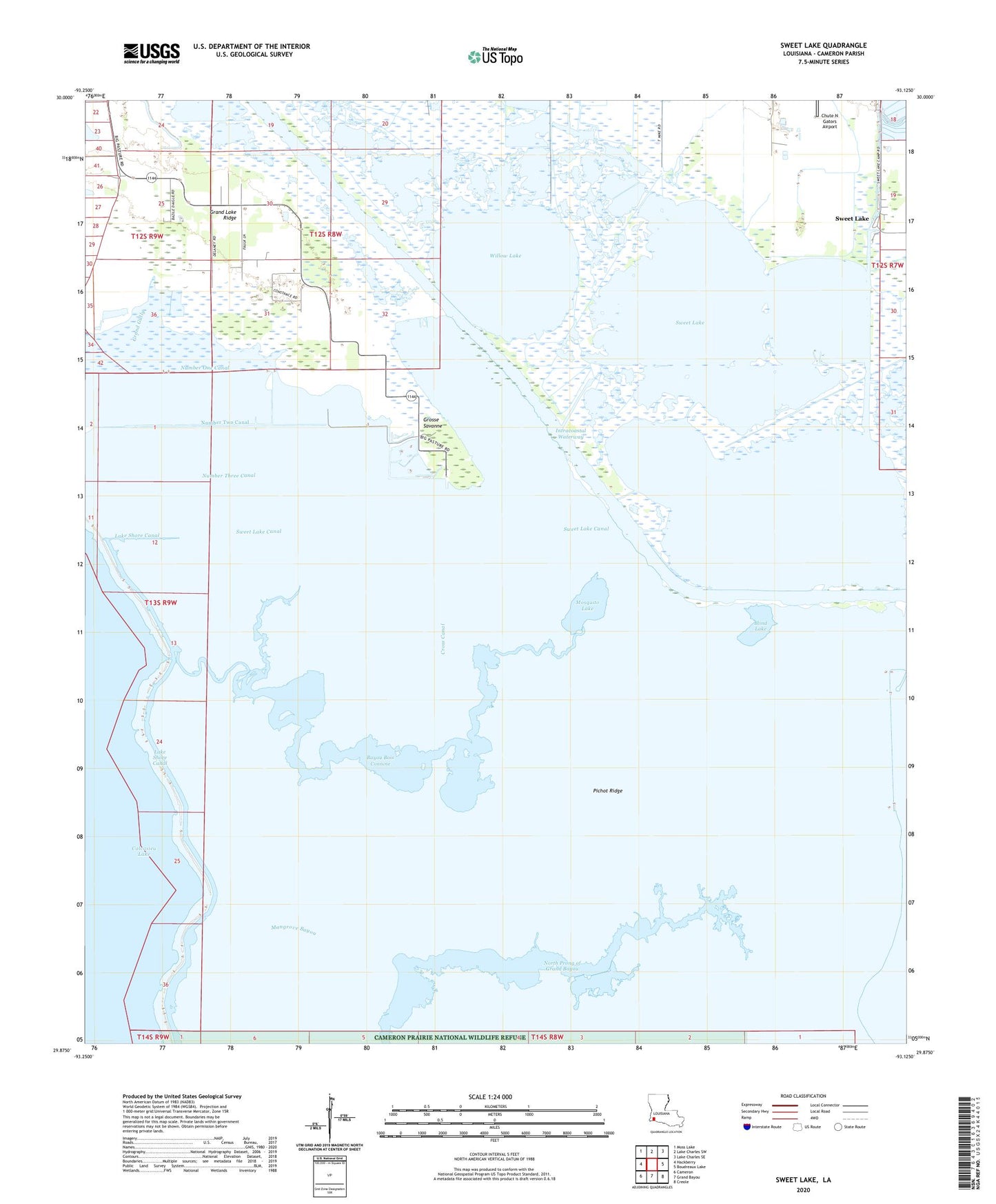
2024 topographic map quadrangle Sweet Lake in the state of Louisiana. Scale: 1:24000. Based on the newly updated USGS 7.5' US Topo map series, this map is in the following counties: Cameron. The map contains contour data, water features, and other items you are used to seeing on USGS maps, but also has updated roads and other features. This is the next generation of topographic maps. Printed on high-quality waterproof paper with UV fade-resistant inks.
Quads adjacent to this one:
West: Hackberry
Northwest: Moss Lake
North: Lake Charles SW
Northeast: Lake Charles SE
East: Boudreaux Lake
Southeast: Creole
South: Grand Bayou
Southwest: Cameron
This map covers the same area as the classic USGS quad with code o29093h2.
Contains the following named places: Bayou Bois Connine, Blind Lake, Chute N Gators Airport, Cross Canal, Grand Gully, Grand Lake Ridge, Grosse Savanne, Mangrove Bayou, Mosquito Lake, North Prong of Grand Bayou, Number One Canal, Number Three Canal, Number Two Canal, Parish Governing Authority District 7, Pichot Ridge, Sweet Lake, Sweet Lake Canal, Sweet Lake Oil Field, Willow Lake