MyTopo
Marsalis Louisiana US Topo Map
Couldn't load pickup availability
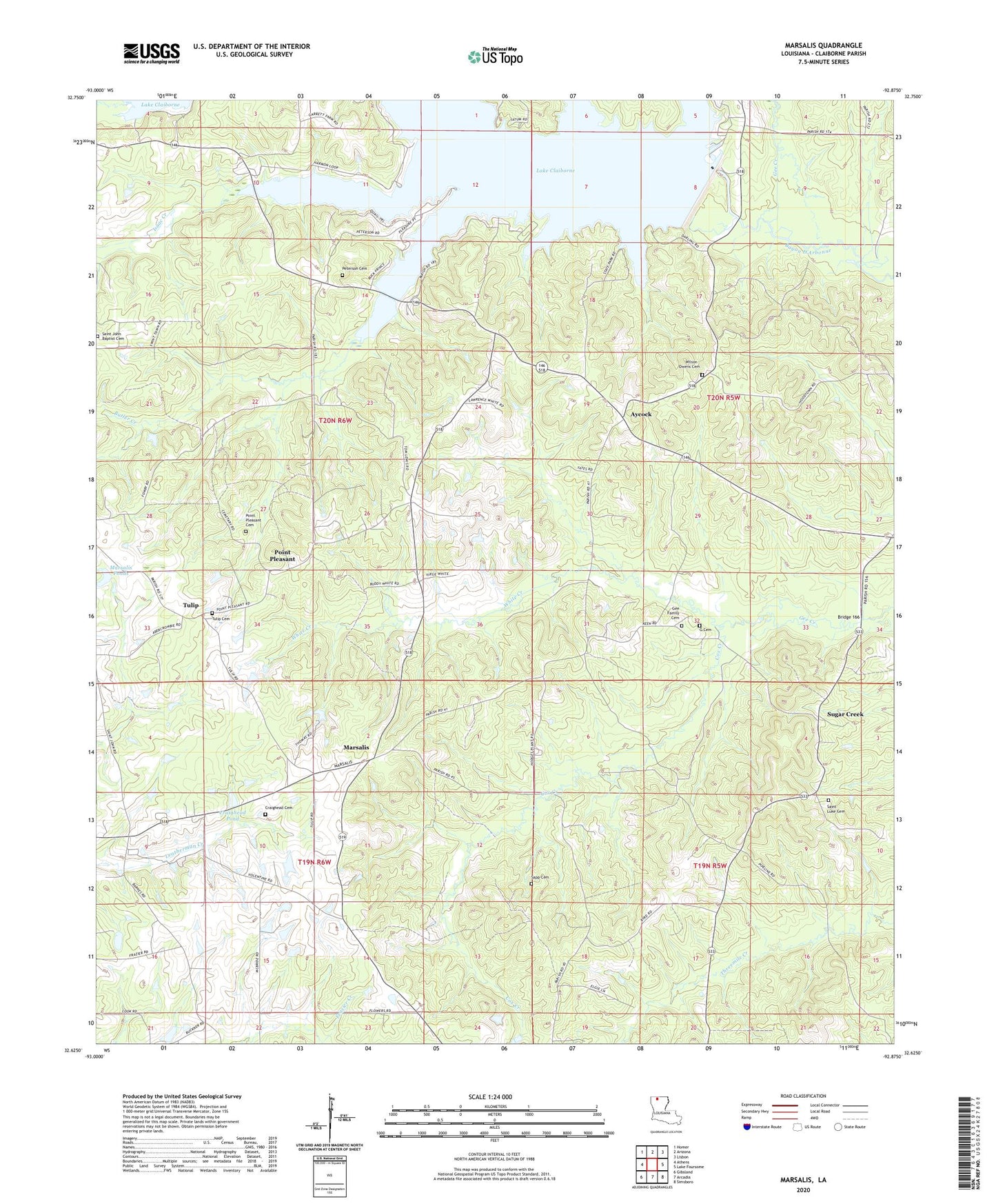
2024 topographic map quadrangle Marsalis in the state of Louisiana. Scale: 1:24000. Based on the newly updated USGS 7.5' US Topo map series, this map is in the following counties: Claiborne. The map contains contour data, water features, and other items you are used to seeing on USGS maps, but also has updated roads and other features. This is the next generation of topographic maps. Printed on high-quality waterproof paper with UV fade-resistant inks.
Quads adjacent to this one:
West: Athens
Northwest: Homer
North: Arizona
Northeast: Lisbon
East: Lake Foursome
Southeast: Simsboro
South: Arcadia
Southwest: Gibsland
This map covers the same area as the classic USGS quad with code o32092f8.
Contains the following named places: Allen Creek, Aycock, Bear Creek, Bridge 166, Butler Creek, Coleman Creek, Cox Creek, Craighead Cemetery, Craighead Pond, D'Arbonne Church, G Cemetery, Gee Creek, Horse Creek, Isaac Creek, Lake Claiborne Dam, Lake Claiborne State Park, Lisbon Oil Field, Marsalis, Marsalis Ponds, Parish Governing Authority District 6, Point Pleasant, Point Pleasant Cemetery, Richland School, Saint Johns School, Saint Luke School, Sapp Cemetery, Sugar Creek, Sugar Creek Oil and Gas Field, Tulip, Tulip Cemetery, Tulip Methodist Church, Ward Six, White Creek