MyTopo
Martello Castle Louisiana US Topo Map
Couldn't load pickup availability
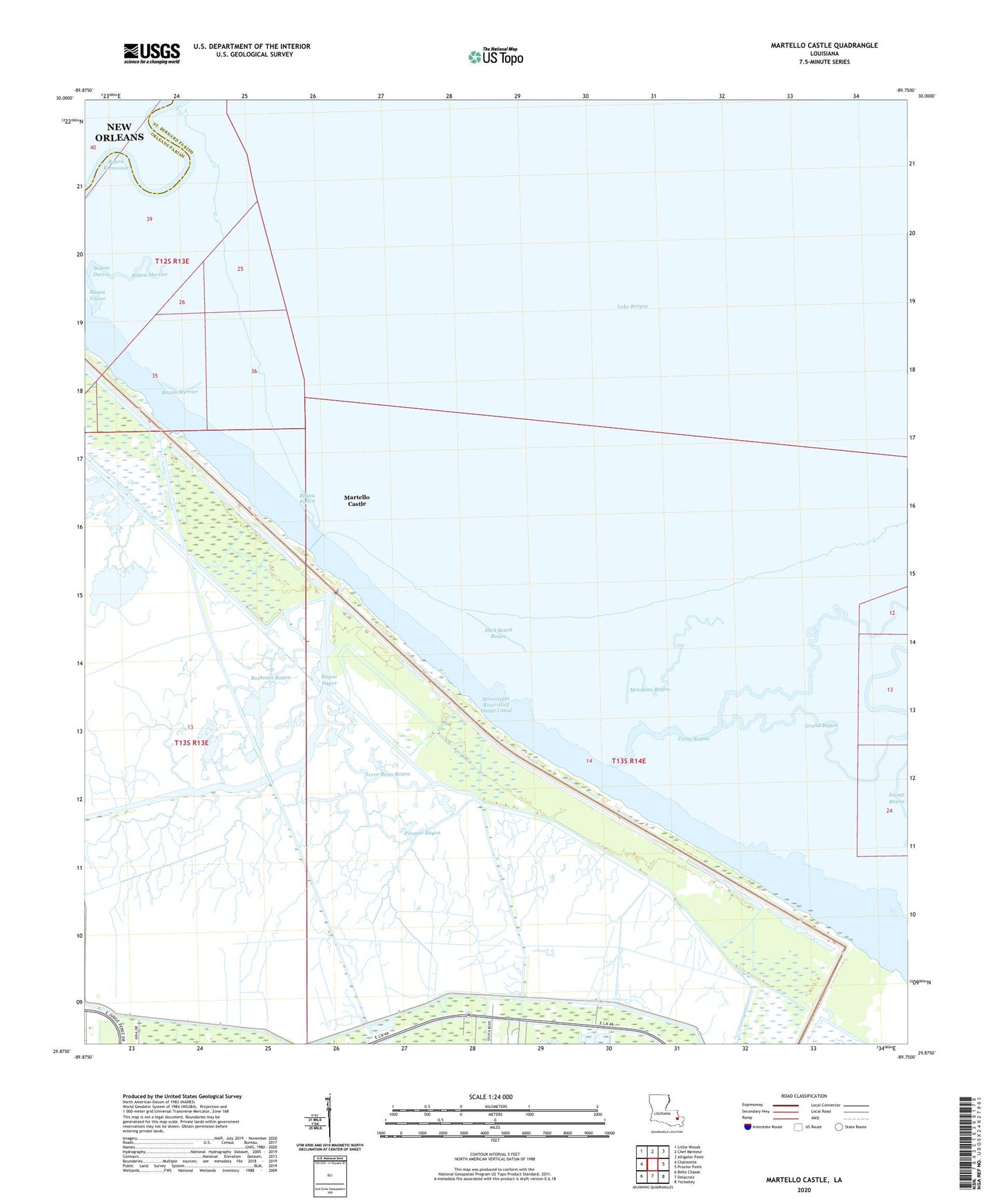
2024 topographic map quadrangle Martello Castle in the state of Louisiana. Scale: 1:24000. Based on the newly updated USGS 7.5' US Topo map series, this map is in the following counties: St. Bernard, Orleans. The map contains contour data, water features, and other items you are used to seeing on USGS maps, but also has updated roads and other features. This is the next generation of topographic maps. Printed on high-quality waterproof paper with UV fade-resistant inks.
Quads adjacent to this one:
West: Chalmette
Northwest: Little Woods
North: Chef Menteur
Northeast: Alligator Point
East: Proctor Point
Southeast: Yscloskey
South: Delacroix
Southwest: Belle Chasse
This map covers the same area as the classic USGS quad with code o29089h7.
Contains the following named places: Bashman Bayou, Bayou Bienvenue, Bayou Ducros, Bayou Dupre, Bayou Mercier, Bayou Pollett, Camp Bayou, Grand Bayou, Martello Castle, Mosquito Bayou, Pirogue Bayou, Shell Beach Bayou, Terre-Beau Bayou