MyTopo
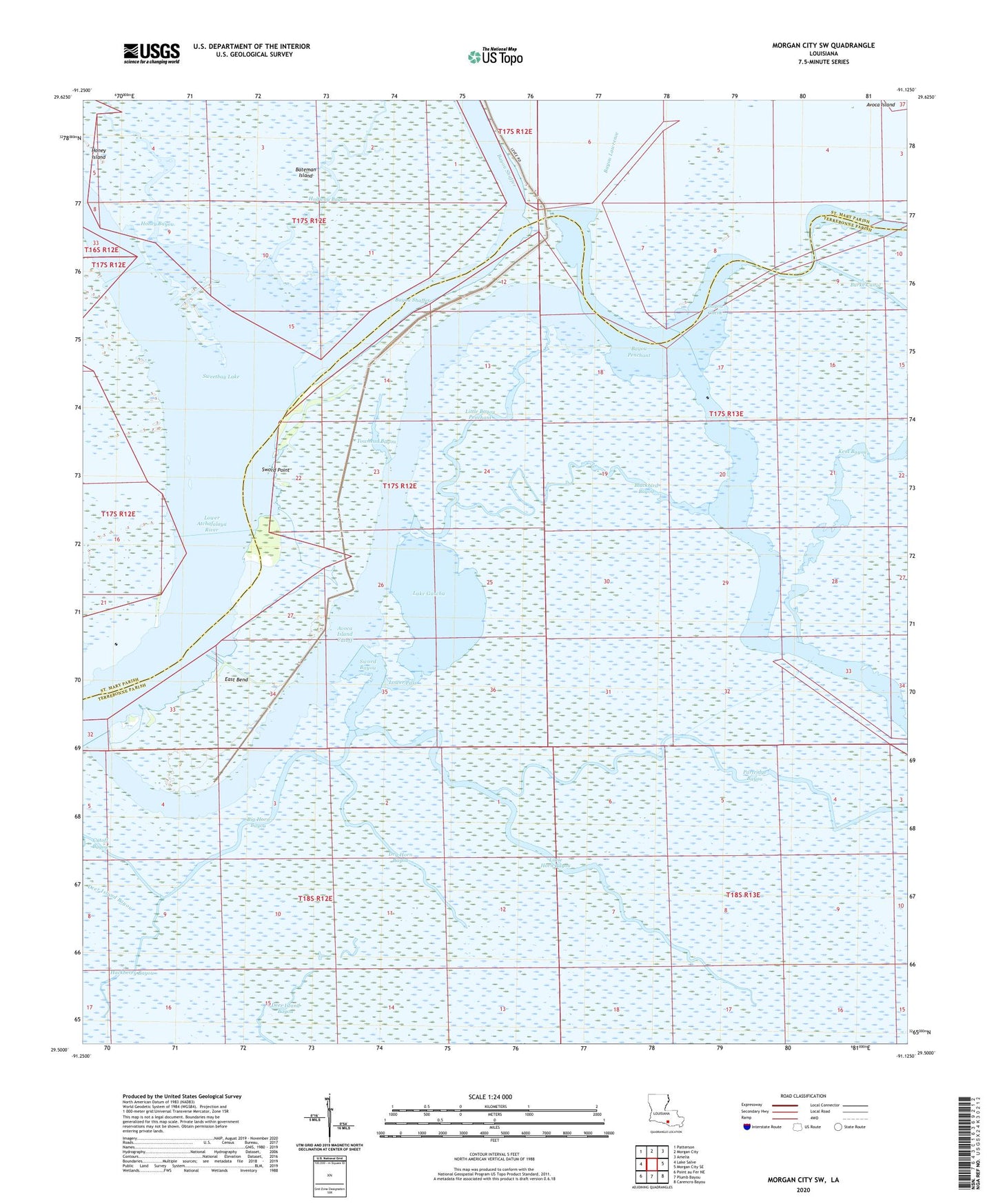
Morgan City SW Louisiana US Topo Map
Couldn't load pickup availability
2020 topographic map quadrangle Morgan City SW in the state of Louisiana. Scale: 1:24000. Based on the newly updated USGS 7.5' US Topo map series, this map is in the following counties: Terrebonne, St. Mary. The map contains contour data, water features, and other items you are used to seeing on USGS maps, but also has updated roads and other features. This is the next generation of topographic maps. Printed on high-quality waterproof paper with UV fade-resistant inks.
Quads adjacent to this one:
West: Lake Salve
Northwest: Patterson
North: Morgan City
Northeast: Amelia
East: Morgan City SE
Southeast: Carencro Bayou
South: Plumb Bayou
Southwest: Point au Fer NE
Contains the following named places: Avoca Island Cutoff, Bayou Lawrence, Bayou Shaffer, Big Horn Bayou, Blackbird Bayou, Cutoff Bayou, Dry Horn Bayou, East Bend, Hackberry Bayou, Halfway Bayou, Honey Bayou, Honey Island, Lake Gascha, Little Bayou Penchant, Little Horn Bayou, Lower Pass, Partridge Bayou, Sweetbay Lake, Sweetbay Lake Oil and Gas Field, Sword Bayou, Sword Point, Towhead Bayou