MyTopo
New Llano Louisiana US Topo Map
Couldn't load pickup availability
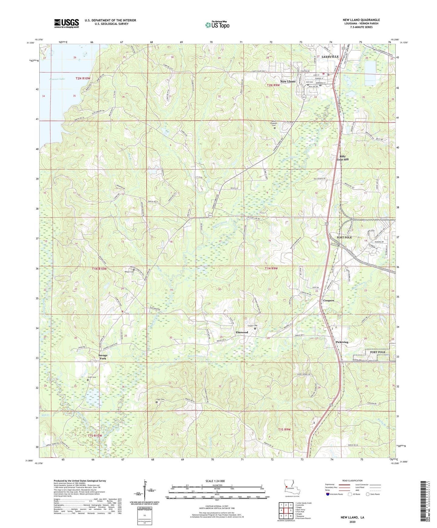
2020 topographic map quadrangle New Llano in the state of Louisiana. Scale: 1:24000. Based on the newly updated USGS 7.5' US Topo map series, this map is in the following counties: Vernon. The map contains contour data, water features, and other items you are used to seeing on USGS maps, but also has updated roads and other features. This is the next generation of topographic maps. Printed on high-quality waterproof paper with UV fade-resistant inks.
Quads adjacent to this one:
West: Burr Ferry
Northwest: Little Sandy Creek
North: Leesville
Northeast: Slagle
East: Fort Polk
Southeast: Hurricane Branch
South: Rosepine
Southwest: Knight
Contains the following named places: Anacoco Lake, Bayou Castor, Bayou Zourie, Big Branch, Billy Goat Hill, Chateau Place, Cooper Baptist Church, Cooper Cemetery, Coopers, Craft Cemetery, Cryer Cemetery, Douglas Memorial Church, Elmwood, Enon Church, First Baptist Church, Gates School, Gill Cemetery, Jackson Chapel Church of God, KCIJ-FM (North Fort Polk), KVVP-FM (Leesville), Leesville Industrial Park, Louisiana Technical College Lamar Salter Campus, Lower Anacoco Dam, Methodist Landing, Mill Creek, Mount Pleasant Cemetery, New Llano, New Llano Fire Department - Station 1, New Llano Police Department, Parish Governing Authority District 8, Pickering, Pickering Elementary School, Pickering High School, Red McManus Camp, Saint Petersburg Church, Savage Fork, Savage Forks Volunteer Fire Association Station 6, Spring Branch, Town of New Llano, Whiteoak Church, Wilson Family Cemetery, Zourie Creek, ZIP Code: 71461