MyTopo
Rosepine Louisiana US Topo Map
Couldn't load pickup availability
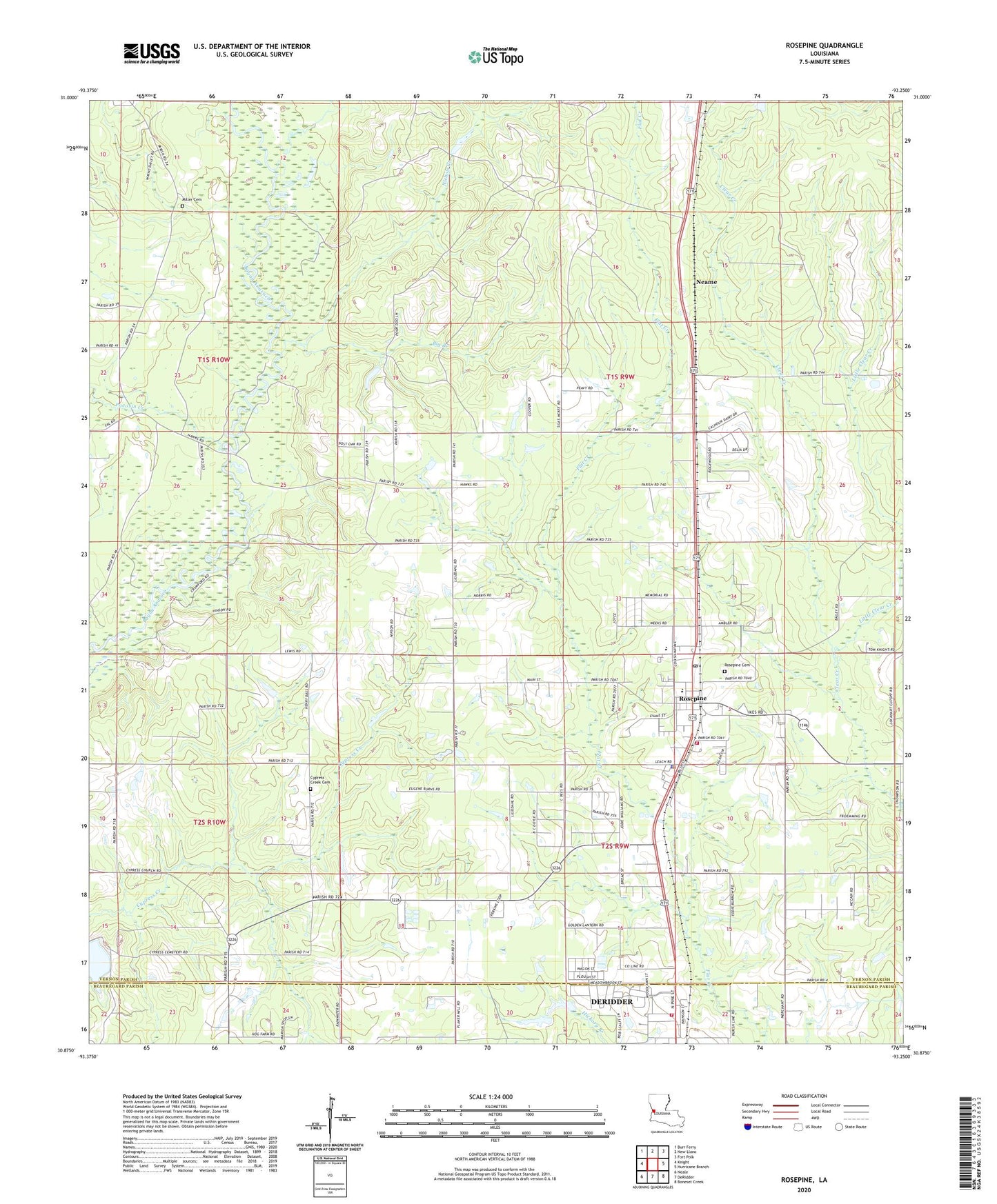
2024 topographic map quadrangle Rosepine in the state of Louisiana. Scale: 1:24000. Based on the newly updated USGS 7.5' US Topo map series, this map is in the following counties: Vernon, Beauregard. The map contains contour data, water features, and other items you are used to seeing on USGS maps, but also has updated roads and other features. This is the next generation of topographic maps. Printed on high-quality waterproof paper with UV fade-resistant inks.
Quads adjacent to this one:
West: Knight
Northwest: Burr Ferry
North: New Llano
Northeast: Fort Polk
East: Hurricane Branch
Southeast: Boneset Creek
South: DeRidder
Southwest: Neale
This map covers the same area as the classic USGS quad with code o30093h3.
Contains the following named places: Big Branch, Cypress Creek Baptist Church, DeRidder Fire Department Northside Station, First Baptist Church of Rosepine, KDLA-AM (De Ridder), KEAZ-FM (De Ridder), KROK-FM (De Ridder), Lewis New Cypress Cemetery, Lillie Church, Little Clear Creek, Louisiana Noname 66 Dam, Louisiana Noname 67 Dam, Miller Cemetery, Neame, Nichols Creek, Ollieville Church, Parish Governing Authority District 1, Pinewood, Pleasantview Church, Pocosin Creek, Rivers of Living Water Church, Rosepine, Rosepine Cemetery, Rosepine Elementary School, Rosepine High School, Rosepine Police Department, Rosepine Post Office, Rosepine United Pentecostal Church, Rosepine Volunteer Fire Department, Shiloh Primitive Baptist Church, Town of Rosepine, Tri Parish Rehabilitation Hospital, Walnut Grove Church, Ward Seven, West Louisiana Experimental Station, ZIP Code: 70659