MyTopo
Little Sandy Creek Louisiana US Topo Map
Couldn't load pickup availability
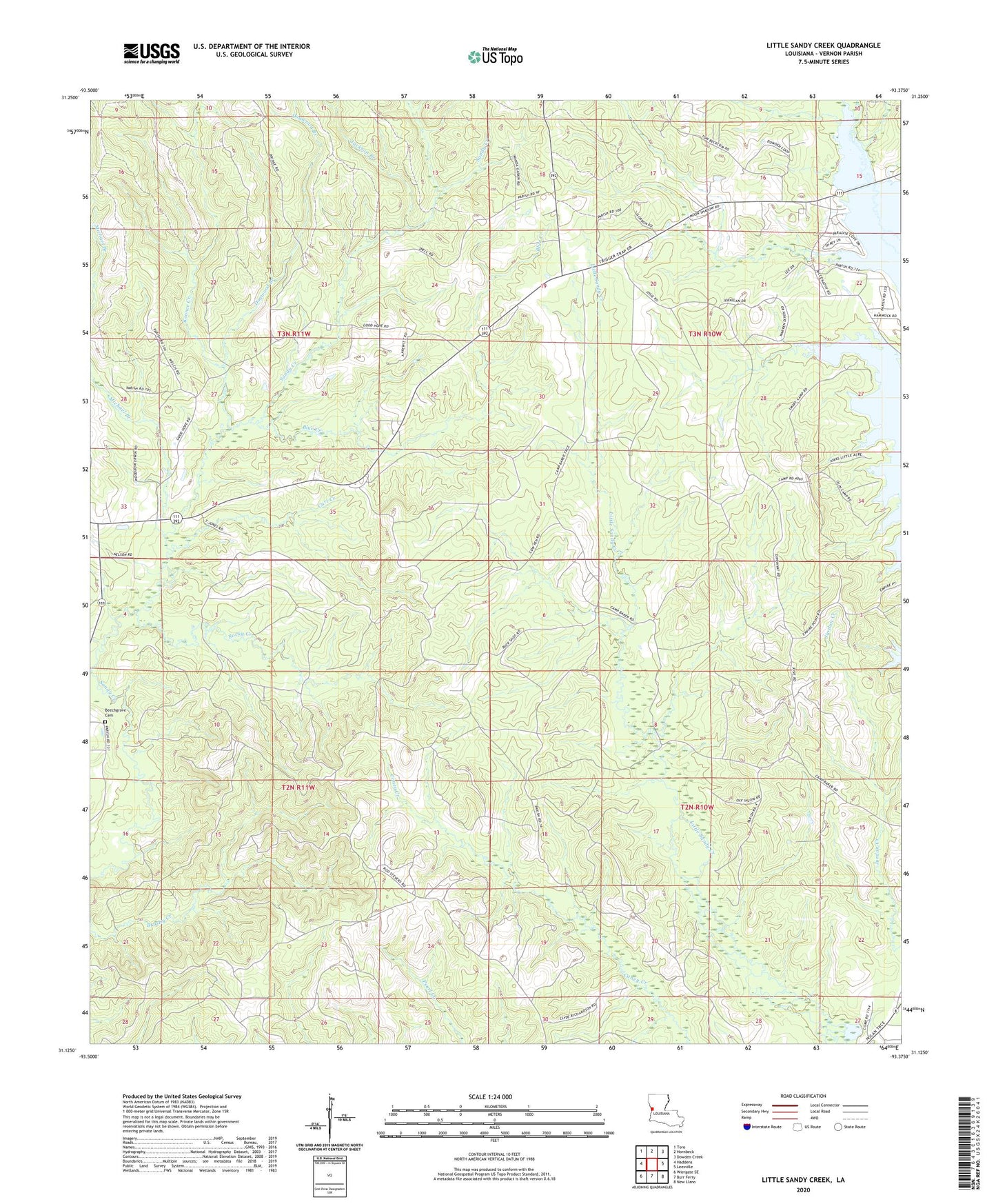
2024 topographic map quadrangle Little Sandy Creek in the state of Louisiana. Scale: 1:24000. Based on the newly updated USGS 7.5' US Topo map series, this map is in the following counties: Vernon. The map contains contour data, water features, and other items you are used to seeing on USGS maps, but also has updated roads and other features. This is the next generation of topographic maps. Printed on high-quality waterproof paper with UV fade-resistant inks.
Quads adjacent to this one:
West: Haddens
Northwest: Toro
North: Hornbeck
Northeast: Dowden Creek
East: Leesville
Southeast: New Llano
South: Burr Ferry
Southwest: Wiergate SE
This map covers the same area as the classic USGS quad with code o31093b4.
Contains the following named places: Beech Grove Congregational Methodist Church, Beechgrove Cemetery, Blue Creek, Cart Creek, Dogwood Branch, Good Hope Baptist Church, Jackson Branch, Koonce Creek, Michael Branch, New Hope Church, Rocky Creek, Sandy Creek Volunteer Fire Department, Ward Two, ZIP Code: 71403