MyTopo
North Shore Louisiana US Topo Map
Couldn't load pickup availability
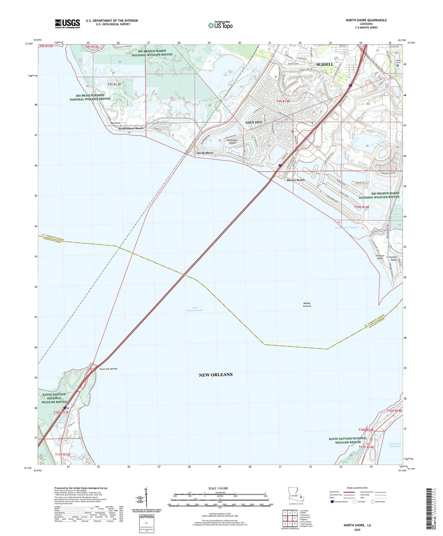
2024 topographic map quadrangle North Shore in the state of Louisiana. Scale: 1:24000. Based on the newly updated USGS 7.5' US Topo map series, this map is in the following counties: St. Tammany, Orleans. The map contains contour data, water features, and other items you are used to seeing on USGS maps, but also has updated roads and other features. This is the next generation of topographic maps. Printed on high-quality waterproof paper with UV fade-resistant inks.
Quads adjacent to this one:
West: South Point
Northwest: Lacombe
North: Slidell
Northeast: Haaswood
East: Rigolets
Southeast: Alligator Point
South: Chef Menteur
Southwest: Little Woods
This map covers the same area as the classic USGS quad with code o30089b7.
Contains the following named places: Bayou Bonfouca, Big Point, Canal Number Eight, Canal Number Four, Canal Number One, Canal Number Seven, Canal Number Six, Canal Number Three, Canal Number Two, Delgado Community College Northshore Slidell Campus, Dream Courts Mobile Home Park, Eden Isle, Eden Isle Census Designated Place, Fields Cemetery, First Baptist Christian School, Fort Pike Chapel, Grand Lagoon, Harmony Heights, Howze Beach, Irish Bayou, Irish Bayou Lagoon, Lake Gardens, Little Irish Bayou, Living the Word International Church, Middle Ground, Moonraker Island, North Shore, North Shore Beach, North Shore Channel, North Shore Chapel, Oak Harbor, Oak Harbor Golf Club, Olimpic Beach, Our Lady of Lords Church, Our Lady of Lourdes Elementary School, Pine Crest Mobile Home Park, Point aux Herbes, Saint Tammany Parish Fire District 1 Station 6, Salmen High School, Slidell Factory Stores Shopping Center, Spanish Trail Highlands, Treasure Island, Upper Room Bible Church, Vanguard College of Cosmetology, Westchester Estates, Windsor Place, Yester Oaks