MyTopo
Olla West Louisiana US Topo Map
Couldn't load pickup availability
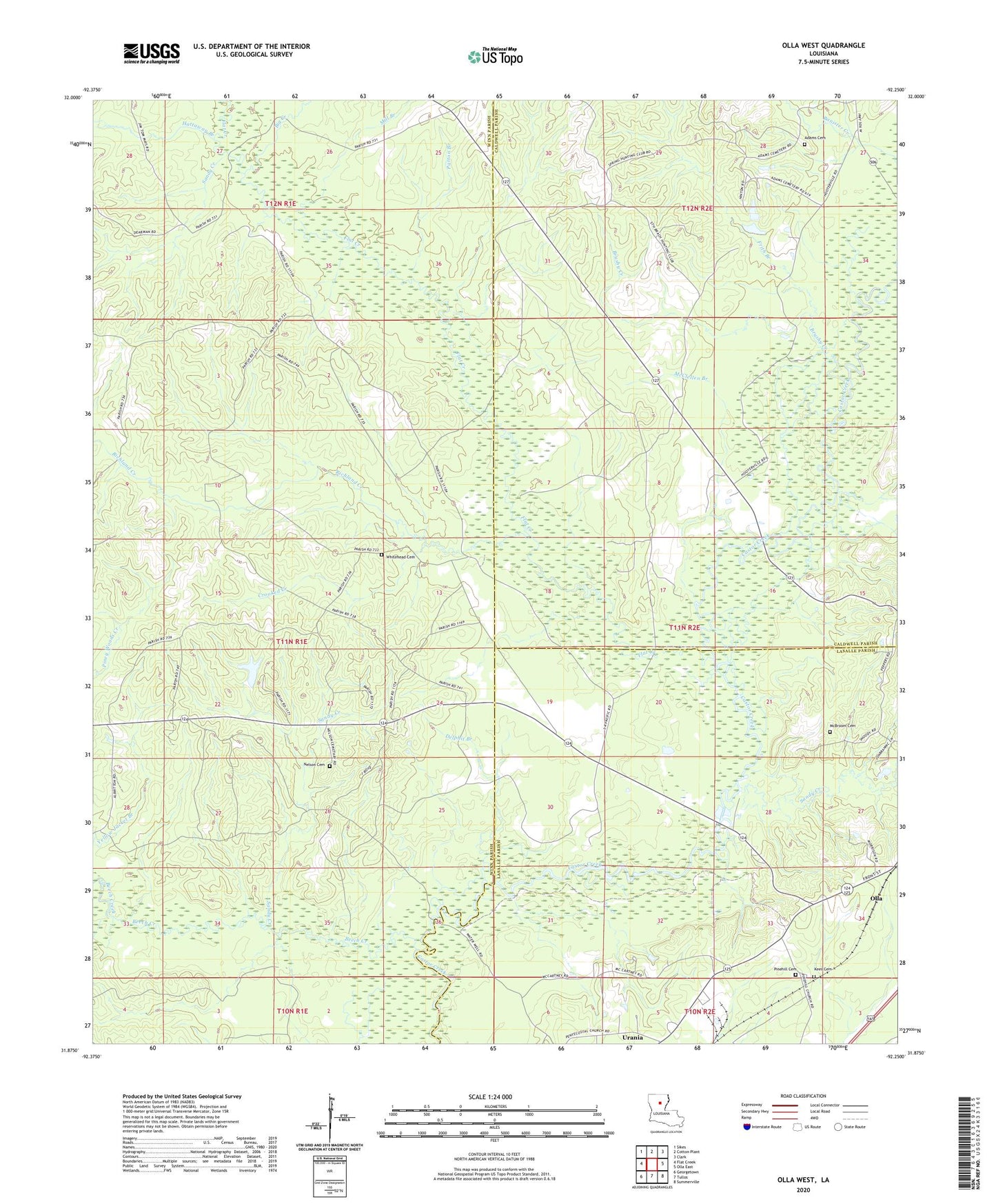
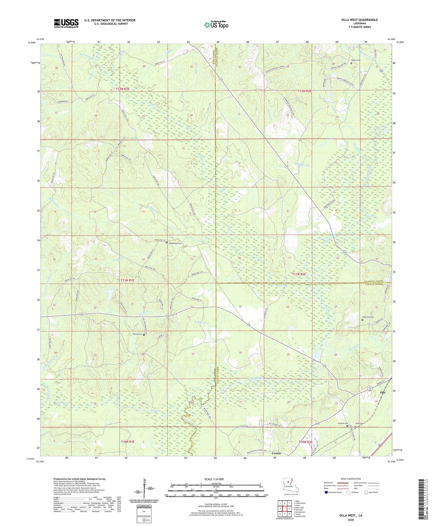
2020 topographic map quadrangle Olla West in the state of Louisiana. Scale: 1:24000. Based on the newly updated USGS 7.5' US Topo map series, this map is in the following counties: Winn, Caldwell, LaSalle. The map contains contour data, water features, and other items you are used to seeing on USGS maps, but also has updated roads and other features. This is the next generation of topographic maps. Printed on high-quality waterproof paper with UV fade-resistant inks.
Quads adjacent to this one:
West: Flat Creek
Northwest: Sikes
North: Cotton Plant
Northeast: Clark
East: Olla East
Southeast: Summerville
South: Tullos
Southwest: Georgetown
Contains the following named places: Adams Cemetery, Beech Creek, Big Creek, Brushy Creek, Crooked Creek, Delphit Branch, Flat Creek, Frith Branch, Hattaway Branch, Kees Cemetery, McBroom Cemetery, McBroom Gas Field, McClellen Branch, Mill Branch, Nelson Cemetery, Patton Branch, Pinehill Baptist Church, Pinehill Cemetery, Richland Creek, Richland Creek Gas Field, Sandy Creek, Sandy Creek Gas Field, Whitehead Cemetery, Zion Hill Baptist Church