MyTopo
Flat Creek Louisiana US Topo Map
Couldn't load pickup availability
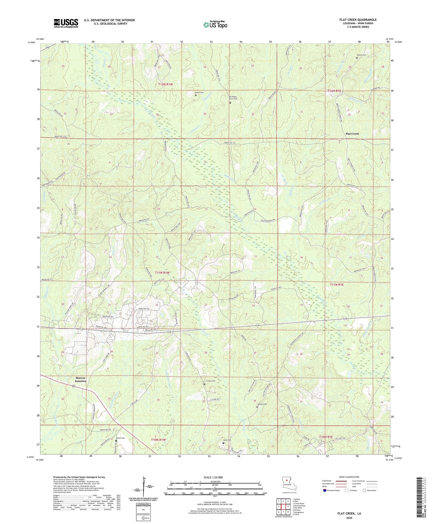
2024 topographic map quadrangle Flat Creek in the state of Louisiana. Scale: 1:24000. Based on the newly updated USGS 7.5' US Topo map series, this map is in the following counties: Winn. The map contains contour data, water features, and other items you are used to seeing on USGS maps, but also has updated roads and other features. This is the next generation of topographic maps. Printed on high-quality waterproof paper with UV fade-resistant inks.
Quads adjacent to this one:
West: Winnfield East
Northwest: Hudson
North: Sikes
Northeast: Cotton Plant
East: Olla West
Southeast: Tullos
South: Georgetown
Southwest: Packton
This map covers the same area as the classic USGS quad with code o31092h4.
Contains the following named places: Adams Cemetery, Beech, Beech Creek Missionary Baptist Church, Caney Creek, Colgrade Oil Field, Corley Cemetery, Crossroads Oil Field, Curry, Curry Oil Field, Flat Creek, Flat Creek Gas Field, Godfrey Branch, Guin Cemetery, Higdon Creek, Holmes Cemetery, James Cemetery, Joe Ed Creek, Murray Junction, Old Shady Grove Cemetery, Oxpen Creek, Parish Governing Authority District 12, Piney Woods Creek, Pool Branch, Royal, Shiloh Cemetery, Smith, Tiger Creek, Tray Creek, Turkey Creek, Wheless Branch Gas Field, Yellow Jacket Branch