MyTopo
Olla East Louisiana US Topo Map
Couldn't load pickup availability
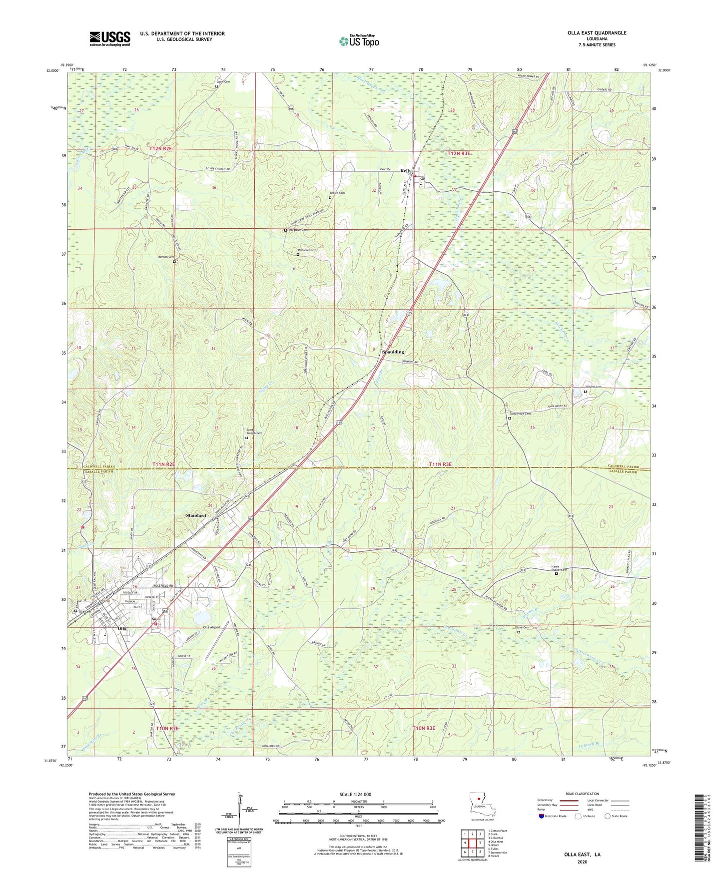
2024 topographic map quadrangle Olla East in the state of Louisiana. Scale: 1:24000. Based on the newly updated USGS 7.5' US Topo map series, this map is in the following counties: Caldwell, LaSalle. The map contains contour data, water features, and other items you are used to seeing on USGS maps, but also has updated roads and other features. This is the next generation of topographic maps. Printed on high-quality waterproof paper with UV fade-resistant inks.
Quads adjacent to this one:
West: Olla West
Northwest: Cotton Plant
North: Clark
Northeast: Columbia
East: Holum
Southeast: Nickel
South: Summerville
Southwest: Tullos
This map covers the same area as the classic USGS quad with code o31092h2.
Contains the following named places: Banister Creek, Bear Branch, Benson Cemetery, Blake Cemetery, Brown Cemetery, Chickasaw Creek Gas Field, Davis, Davis Cemetery, Good Hope Baptist Church, Good Hope Cemetery, Hargrove Cemetery, Harris Chapel, Harris Chapel Cemetery, Kelly, Kelly Baptist Church, Kelly Elementary School, Kelly Post Office, Kelly School, Kelly Volunteer Fire Department, LaSalle High School, McDaniel Cemetery, Mill Pond, North Rabbit Branch Gas Field, North Standard Gas Fields, Olla, Olla Airport, Olla Cemetery, Olla Elementary School, Olla Police Department, Olla Volunteer Fire Department Station 1, Olla Volunteer Fire Department Station 2, Olla-Standard High School, Pleasant Ridge Baptist Church, Rabbit Branch, Saint Joseph Cemetery, Spaulding, Spaulding Gas Field, Standard, Standard Baptist Church, Standard Gas Field, Standard School, Tidwell Cemetery, Town of Olla, Ward Two, ZIP Codes: 71441, 71465